


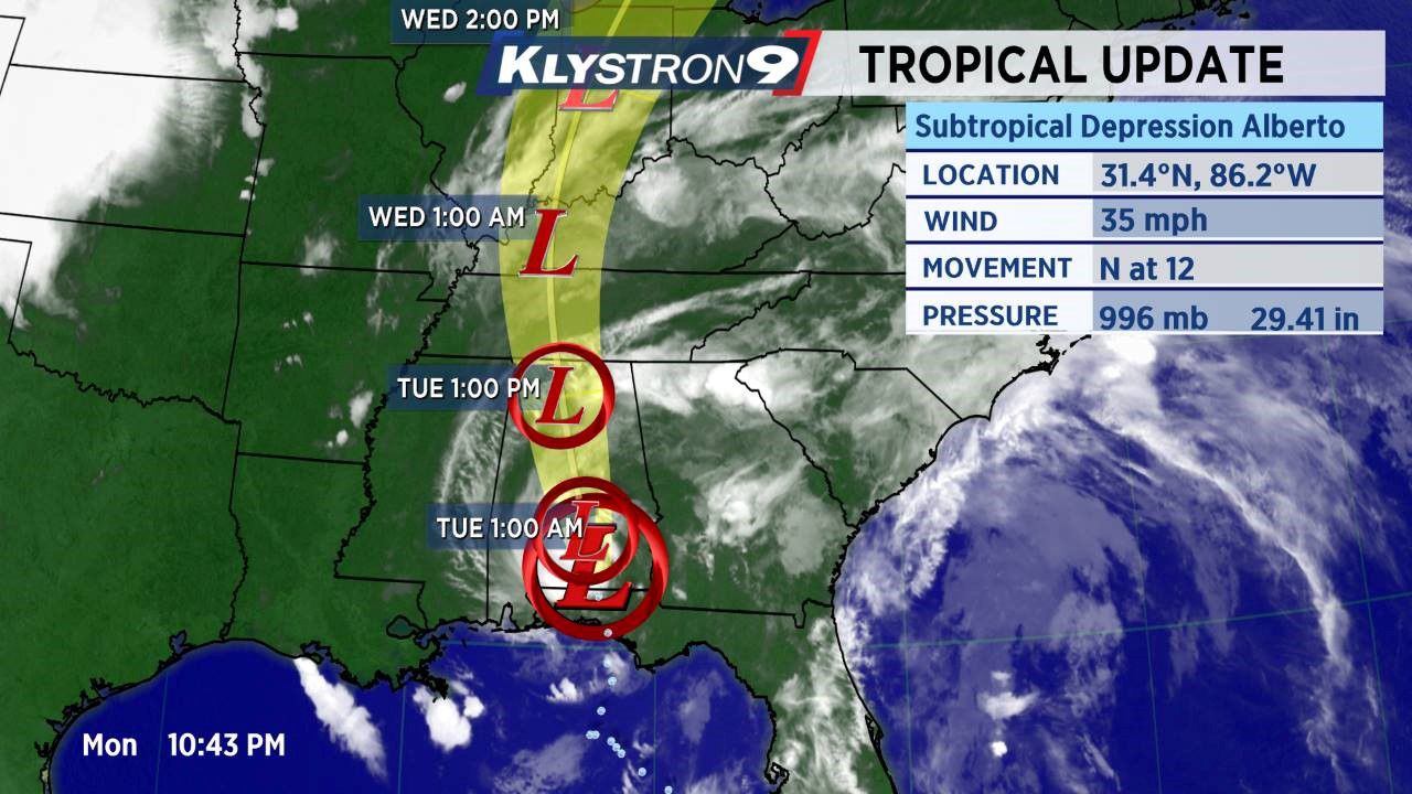
Subtropical Storm Alberto made landfall in the Florida panhandle near Laguna Beach around 4:45 p.m. Monday.
- SEE BELOW: Statement from Gov. Scott on Florida State of Emergency
- SEE ALSO: Sandbag locations in Bay area
- GET WEATHER ALERTS: Sign up to receive weather text alerts from Spectrum Bay News 9
- RELATED:
The latest advisory now has Alberto with winds of 35 mph and about 50 miles west-northwest of Dothan, Alabama. Alberto is moving north at 12 mph with a minimum pressure of 996 mb.
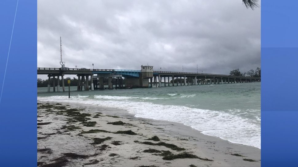
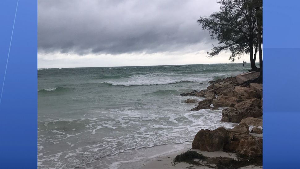
There will continue to be a risk of rip currents along the Gulf beaches.
We will continue to see gusty winds through Tuesday, out of the south. Rip current risk will continue as well.
A Small Craft Advisory is in effect through Tuesday for the Gulf waters and Tampa Bay.
PREVIOUS UPDATES
5 p.m. Monday --
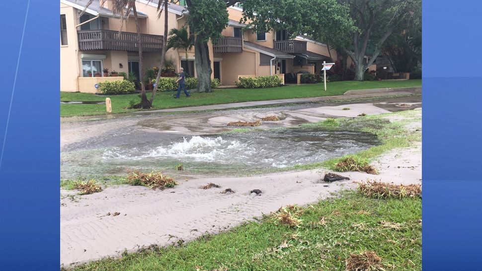
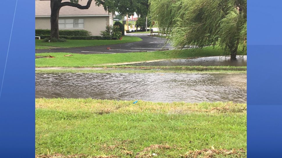
For Monday, we will see occasional gusty showers move from south the north across the Bay area.
Tides will run about 1 to 2 feet above normal astronomical tides.
Boating conditions will be hazardous, with winds South at 15 to 25 knots, seas 6-8 feet.
Tropical Storm Warnings continue from the Alabama/Mississippi border to the Suwanee River in northern Florida.
6:50 a.m. Monday --
Alberto still has winds at 65 mph, and is expected to make landfall sometime Monday.
11 a.m. Sunday --
There really isn't much change in Alberto, although it is transitioning to fully tropical as expected.
It will strengthen some before landfall along the Floridan panhandle Monday. As it pulls away, our wind will become more SSW and we will have a 1-to-2 foot above normal high tide Monday.
We also will continue with on and off rain showers with occasional gusty wind Sunday.
5 a.m. --
Alberto has changed little since Saturday night. It is showing signs of transitioning to something more tropical as deeper convection has developed near the center.
It is still being influenced by an upper level low, which for now, is providing shear and Alberto's asymmetrical look. Eventually the upper low will act to pull Alberto back to the North-northwest later Sunday.
Since it has been pushing north-northeast over the last 6 to 12 hours, its slightly closer approach to the west coast of Florida has prompted tropical storm warnings to be posted for the coastline. This means that tropical storm conditions (winds of 40 mph sustained) are possible.
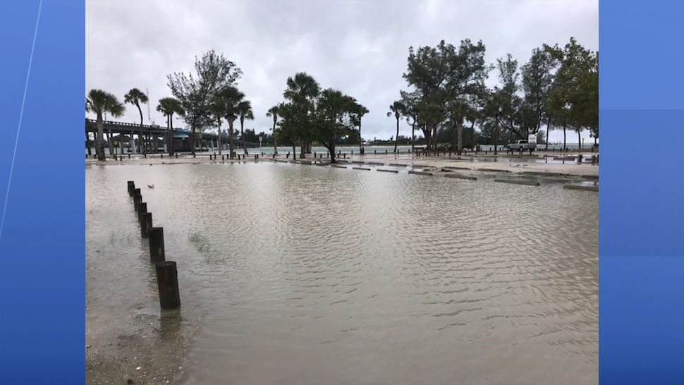
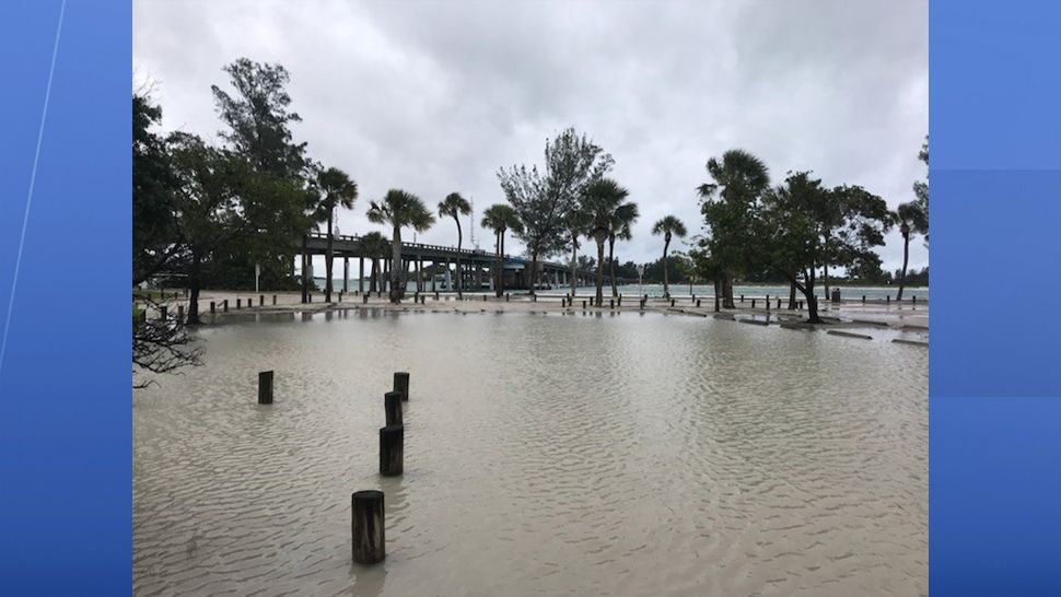
Many may see some tropical storm force wind gusts along the coast but not necessarily sustained winds. There is also a minor concern for some coastal flooding at the times of high tide. High tides will occur this afternoon and very early Monday morning.
The latter will have the better chance of seeing water rise as at that time we will have a more on shore wind component. With that said, water rise should be relatively minimal and really will be from Crystal River northward along the Florida coast toward the Panhandle.
Our weather today will have periods of rain, some will be heavy at times. But, there will be times when it is not raining.
A slot of dry air is rotating around the southern edge of Alberto and that may act to cut off our rain for a period of time mid day today.
However, if the atmosphere can warm even a little in that slightly drier air, then extra showers and thunderstorms will fill that in. The is also a very slight risk for some tornadoes Sunday, especially if we get some added heating.
With Alberto nearing the Florida Panhandle Monday, we will still be on the wet side of the system and our rain chances will remain elevated. Because of the potential for higher rain totals over the next two days, a flood watch continues.
Chance of heavy rains may cause flooding
Due to the threat of heavy rain and potential flooding, Gov. Rick Scott has declared a state of emergency in all 67 Florida counties.
“As we continue to monitor Subtropical Storm Alberto’s northward path toward Florida, it is critically important that all Florida counties have every available resource to keep families safe and prepare for the torrential rain and severe flooding this storm will bring. Today, I have declared a state of emergency in all 67 Florida counties to make sure that our state and local governments are able to coordinate with federal partners to get the resources they need," Scott said.
Pasco County is currently under a Tropical Storm Warning.
Residents in the western portion of the county can expect sustained winds of 20 to 30 miles an hour with gusts up to 40 miles an hour--mainly along the U.S. 19 and Little Road corridors--beginning early this afternoon into the early overnight hours Monday.
Alberto is expected to bring 2 to 4 inches of rain to Pasco County.