


The USF College of Marine Science is teaming up with the Florida Institute of Oceanography to map the entire Florida coast, as well as gather data on fish spawning areas in the state's coastal waters.
- Researchers developing maps of essential sealife habitats
- Florida Coastal Mapping Program capturing high resolution maps of coast
- Less than 20 percent of Florida's coastal waters have been mapped
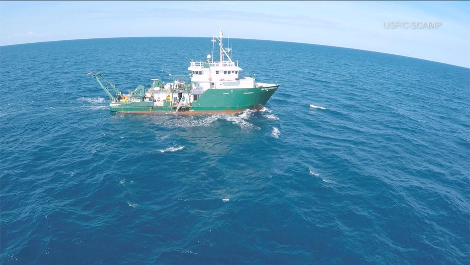
Researchers from the two schools are pushing forward a number of projects while working onboard the Weatherbird II research vessel in the Gulf of Mexico.
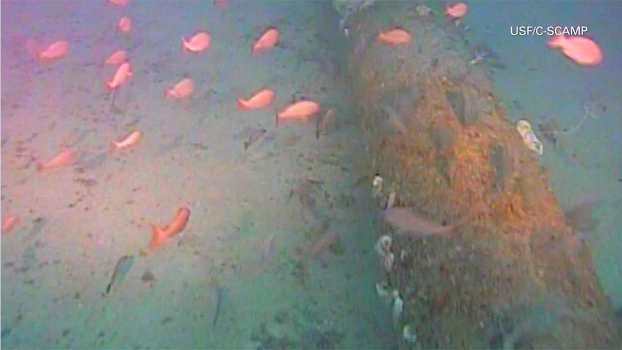
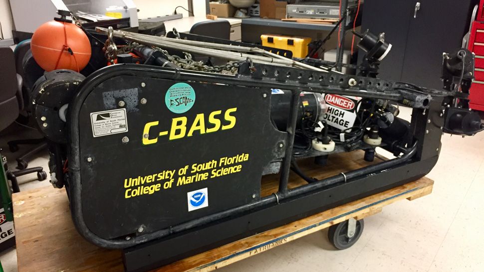
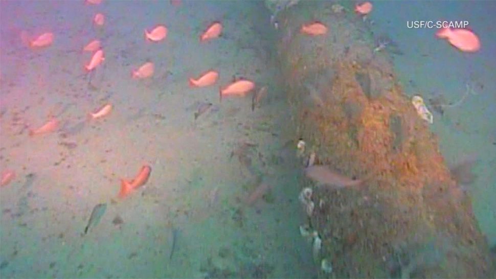
One of those projects involved gathering HD video of the sea bottom to count the number of Red Snapper in the gulf utilizing an instrument called a "C-BASS." The Weatherbird tows the C-BASS about six feet off the bottom of the ocean floor and utilizes lights and cameras to capture all the action.
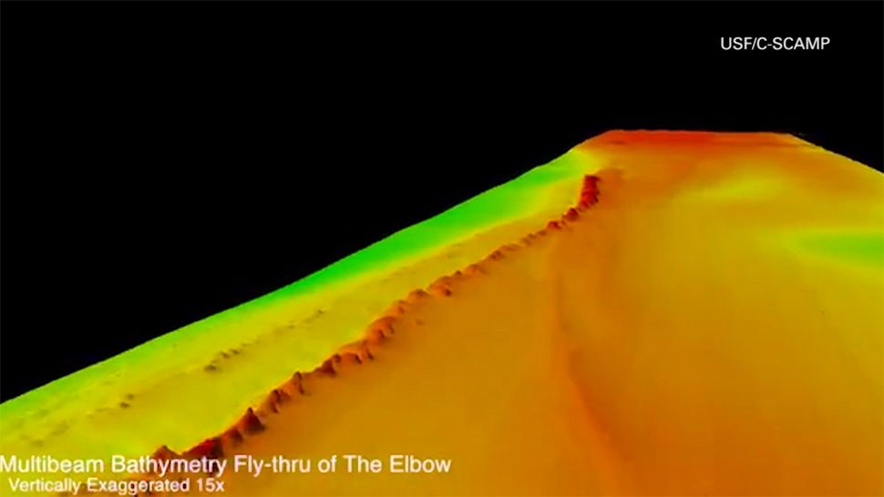
It's all part of the C-SCAMP project, which is also developing high-resolution multibeam maps to identify essential habitats on the West Florida shelf.
"It’s really important not only for just finding out what’s there, but also for the management of our natural resources," said USF Professor Steve Murawski. "So, we’re trying to close this huge gap in terms of our understanding of what’s on the sea floor and how valuable it is.”
The C-SCAMP project is funded by BP oil spill money and is expected to wrap up next year.
The Weatherbird II is also part of another project called the Florida Coastal Mapping Program. The goal is to capture high resolution maps of the entire Florida coast.
The Florida Institute of Oceanography is leading the FCaMap initiative, looking to address the fact that less than 20 percent of Florida's coastal waters have been properly mapped.
"We're really pushing to have the entire state mapped at these new modern-day standards," said Dr. Philip Kramer, "so that we're not using charts and data from decades or hundreds of years ago."
It's expected to take ten years and cost $100 million to map the entire state to the new standard.