


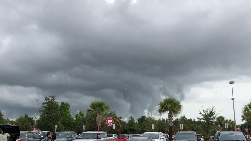
ST. PETERSBURG, Fla. — Here's your Tampa area weather forecast for late Thursday into Friday morning, along with a detailed look at conditions this weekend.
- P.M. storms Friday
- Fewer storms for weekend
- Hotter temperatures
Scattered storms will slowly wind down this evening with partly cloudy skies overnight.
Friday will start out quiet, with morning lows in the low to mid 70s inland and upper 70s at the coast.
Storms will start forming around midday as the sea breeze slowly comes in from the gulf. They will then tend to be scattered into the evening.
Highs will reach the low 90s before the storms begin.
The storms will ultimately wind down with a northwestward movement toward the Gulf.
- WEATHER ON THE GO: Download the Spectrum Bay News 9 app and get Klystron 9 alerts wherever you are.
- GET WEATHER ALERTS: Sign up to receive weather text alerts from Spectrum Bay News 9
- Klystron 9 | 7-Day forecast | Tampa Bay-area temperatures | Travel weather
This weekend will feature drier air in our upper atmosphere, therefore decreasing the number of storms.
The few that form will come much later in the day into the evening and all have a westward movement toward the Gulf of Mexico.
Since there will be fewer storms, expect it to be hotter, with highs in the mid 90s both weekend days.
7-day forecast
