


ST. PETERSBURG, Fla. — Here's your Tampa area weather forecast for late Monday into Tuesday, along with a preview of conditions through the work week.
- Wind from the east
- P.M. thunderstorms
- Westward movement
- SEE BELOW: See our 7-day forecast ▼
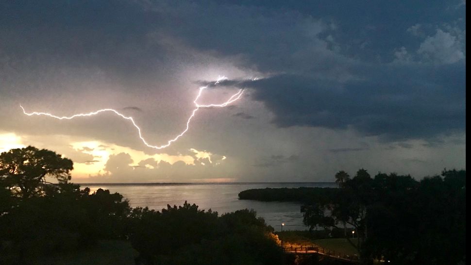
The east wind resulted in big storms moving westward across the region into the Gulf of Mexico.
In this type of pattern the movement is very predictable, with all the storms in the evening headed westward. There will be a couple of isolated lingering showers, but otherwise skies will slowly clear out overnight into early Tuesday morning.
Lows will be in the low to mid 70s inland, but upper 70s near the coast.
- WEATHER ON THE GO: Download the Spectrum Bay News 9 app and get Klystron 9 alerts wherever you are.
- GET WEATHER ALERTS: Sign up to receive weather text alerts from Spectrum Bay News 9
- Klystron 9 | 7-Day forecast | Tampa Bay-area temperatures | Travel weather
Tuesday will feature the same pattern, with sunny skies for the morning and then scattered storms in the afternoon moving westward across the region and toward the gulf.
Since the winds will be blowing from the east, that will keep our sea breeze pinned at the coast. As a result, it will be hot before the storms blow through. Expect highs in the mid 90s for most spots.
The coolest spots will likely be in Polk County because that’s where the storms will start first.
Wednesday will feature the same pattern. Just keep in mind in this pattern it’s hot and dry for the first half of the day, but then big storms can be expected late in the day, converging on our coastal regions and moving west into the gulf each evening.
7-day forecast

We want your pictures!
Show us what the weather looks like in your neighborhood. Your photo could end up on Spectrum Bay News 9.
- Get the Spectrum Bay News 9 app for iOS or Android
- Tap "Submit Content" at the bottom of the app menu
- Remember to include your name and location