


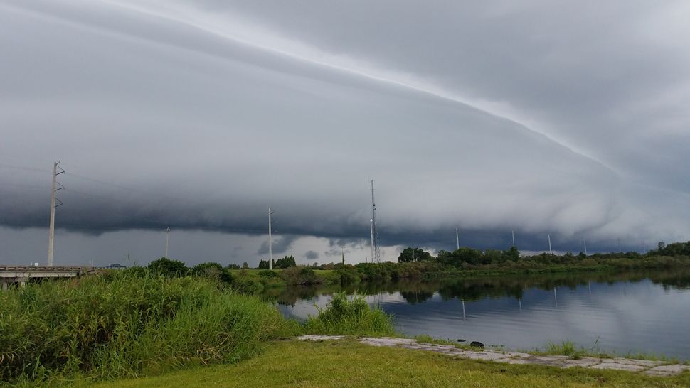
ST. PETERSBURG, Fla. — The storms moved through more quickly Thursday than the past couple of days, so we’ll have clearing skies overnight. However, there will still be a few scattered showers coming in from the east from time to time overnight into early Friday morning.
- East wind continues
- P.M. storms continue
- Tropical wave passes
Expect a mostly quiet Friday morning with partly sunny skies and lows in the low to mid 70s.
Highs will quickly rise to the low 90s by the early afternoon. Then scattered storms will begin.
They will start along the sea breeze as it comes in from the Gulf of Mexico, and also more storms will come from the other side of the state from the east.
The result will again be a high coverage of thunderstorms that ultimately move westward into the gulf by the evening. The coverage will be at about 60 percent.
The storms will die down Friday evening with lows in the low to mid 70s.
- WEATHER ON THE GO: Download the Spectrum Bay News 9 app and get Klystron 9 alerts wherever you are.
- GET WEATHER ALERTS: Sign up to receive weather text alerts from Spectrum Bay News 9
- Klystron 9 | 7-Day forecast | Tampa Bay-area temperatures | Travel weather
Saturday will feature the same type of pattern, but there will be a slight difference in that there will be slightly lower moisture content in the atmosphere.
As a result, expect slightly lower coverage of thunderstorms, at about 50 percent. Highs will be in the low to mid 90s before the storms begin.
We expect a big plume of moisture to pass through Tuesday as a tropical wave passes by to our south. That will result in numerous showers and we could easily approach 100 percent coverage while it passes, so be prepared for a slightly different pattern than we are used to during that time.
The highs will drop a little during that time, mainly into the upper 80s.
TROPICS
The tropical wave coming off the coast of Africa is developing as expected and will be our next tropical storm. The good news is it will never be a threat to the U.S., as it will stay out over the Atlantic Ocean.
The tropical wave in the far eastern Caribbean will eventually pass just to our south early next week and increase our rain chance. The good news there is it doesn’t show any signs of developing.
Even if it did try, wind shear would likely keep it very weak and passing harmlessly by.
Wednesday's rainfall totals: (in inches)
3.29 Belleair
2.76 Palm Harbor
2.63 Carrollwood
2.46 Weeki Wachee
2.04 New Port Richey
1.89 Ruskin
1.51 Homosassa
1.47 Bradenton
1.40 Clearwater
1.38 Tampa
0.99 Plant City
0.89 Crystal River
0.84 Brooksville
0.76 Land O Lakes
0.61 Lakeland
0.57 St. Petersburg
0.35 Lakewood Ranch
0.20 Winter Haven
FLOOD WARNINGS
Flood Warning for
The Alafia River At Lithia
- From late tonight until Saturday afternoon.
- At 08 PM Thursday the stage was...12.8 feet.
- Minor flooding is forecast.
- Flood stage is 13.0 feet.
- The river is forecast to rise above flood stage by after midnight tomorrow and continue to rise to near 13.2 feet by tomorrow morning.the river is expected to fall below flood stage by Saturday morning.
- Impact...at 13.0 feet...River Drive and Squirrel Run Way downstream of County Road 640 are completely covered by water. One home begins to flood.
- Impact...at 12.0 feet...Water begins to affect River Drive and Squirrel Run Way downstream of County Road 640.
...Flood Warning extended until late Saturday night...
The Flood Warning continues for
The Withlacoochee At Trilby
- Until late Saturday night.
- At 08 PM Thursday the stage was 12.2 feet.
- Minor flooding is occurring and Minor flooding is forecast.
- Flood stage is 12.0 feet.
- The river will continue rising to near 12.3 feet by tomorrow morning. The river is expected to fall below flood stage Saturday evening.
- Impact...at 12.0 feet...Flooding begins at Lacoochee, Talisman Estates, Riverdale, and River Height Estates.
Flood Warning extended until further notice...
The Flood Warning continues for
The Cypress Creek At Worthington Gardens
- From after midnight tomorrow through further notice.
- At 08 PM Thursday the stage was 7.8 feet.
- Minor flooding is forecast.
- Flood stage is 8.0 feet.
- Forecast to rise above flood stage by after midnight tomorrow and continue to rise to near 8.8 feet by Sunday early afternoon.
- Impact...at 8.0 feet...Flooding begins at the recreation area on State Road 54.
7-day forecast

We want your pictures!
Show us what the weather looks like in your neighborhood. Your photo could end up on Spectrum Bay News 9.
- Get the Spectrum Bay News 9 app for iOS or Android
- Tap "Submit Content" at the bottom of the app menu
- Remember to include your name and location