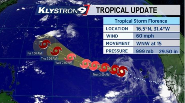
TAMPA, Fla. -- Tropical Storm Florence in the far eastern Atlantic ocean has gotten a little better organized.
- Florence should remain very far to the east of Florida
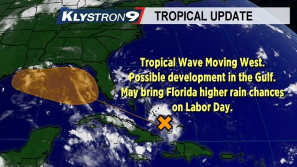
- Watching tropical wave that could increase rain chances
- More: Track the Tropics on Spectrum Bay News 9
It is still fightning dry air and some wind shear but winds have increased to 60 mph. It is expected to continue its WNW movement for the next 5 days.
After that, it will likely find a weakness in the big Atlantic high pressure area and turn north. There is some uncertainty as to when and where that turn occurs but regardless of that it should remain very far to the east of Florida.
Closer to home, a tropical wave over the Bahamas will continue to move toward and eventually over South Florida. This wave will not develop into anything before reaching Florida.
It will increase the moisture over the state leading to higher rain chances Labor Day and Tuesday. However, once it moves past the state and into the Gulf, there is a window of opportunity for some minor development as it moves westward and away from Florida.