


If the thought of earlier sunsets didn’t make you grab that pumpkin iced coffee, then perhaps the drier fall-like air mass this morning did.
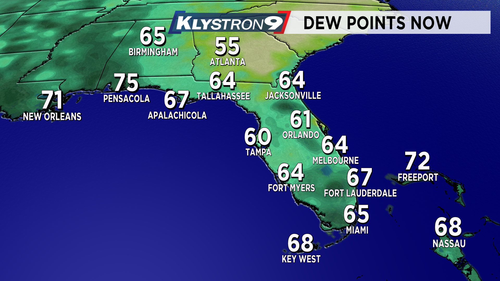
Temperatures bottomed out in the low to mid-70s but the big difference you probably felt was the lack of humidity. Our dew points fell about ten degrees.
Just the other day, the dew points were in the mid-70s. That kind of moisture would make anyone break a sweat just by walking to your car — today it is much more comfortable.
A back door front from the east delivered the drier air last night. That is why we had numerous showers and thunderstorms.
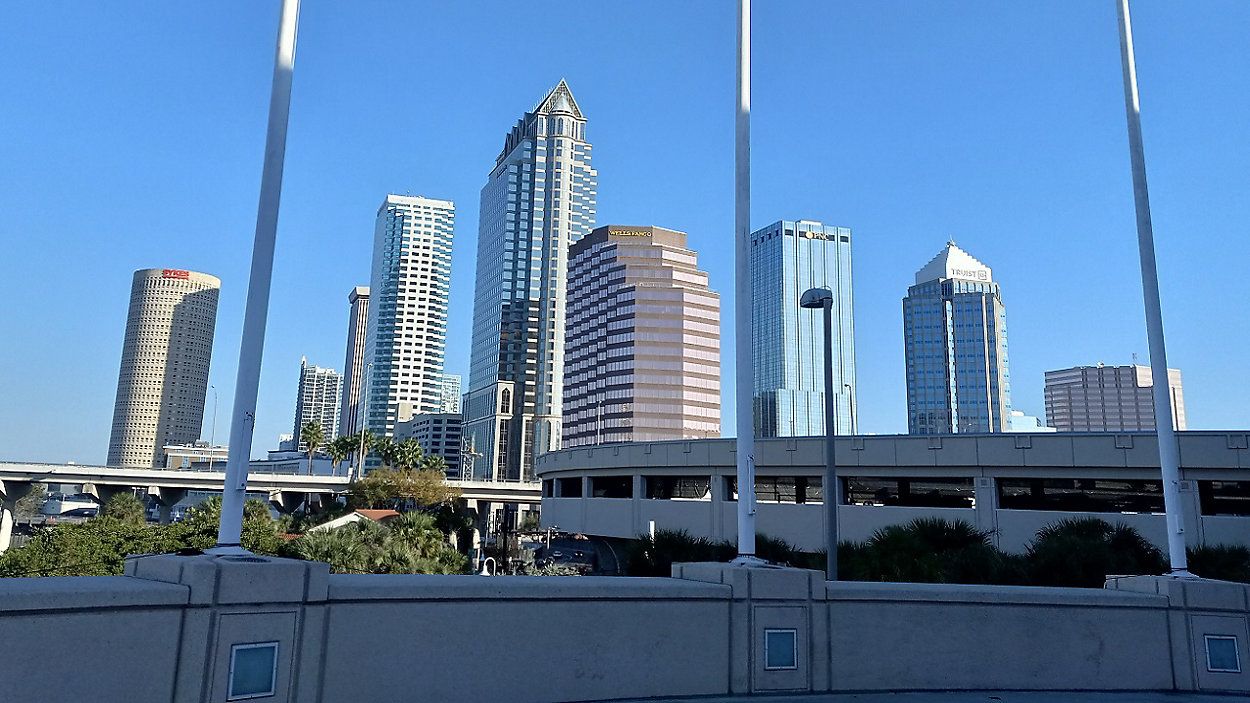
The nice part was when the storms moved west of the area it left us with a vibrant sunset that was as colorful as candy corn. Today, the sky is bluer, it is comfortable and the frizz-factor is lower for those with sensitive hair.
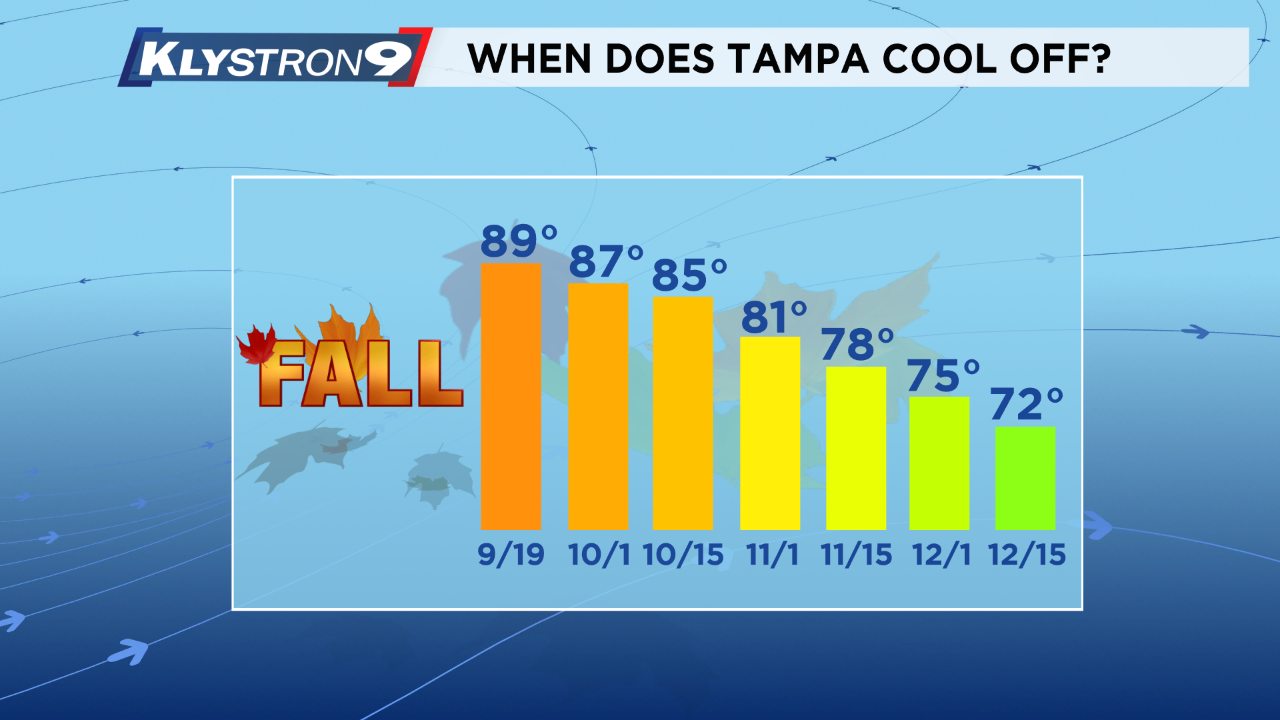
The point I am getting at is cooler weather is coming. We are at the point where Tampa’s average high temperature starts to decrease. While it won’t happen overnight, it will eventually come.
It may surprise some of you that our average high temperature remains above 80 degrees through early November. After November 1, our average high temperature cools off quickly.
By December 15, our averages are cooler than the other side of my pillow, with high temperatures peaking in the low 70s
The leaves have already started to turn across the Northern Tier of the country and the cold air continues to build over Canada. The cold air will have to spill south over the next few weeks.
This happens in the form of a cold front. In Tampa, the first true cold front is a big deal. It will be awhile before we see one here but at least our small drop in dew points is a start.
So enjoy our break in the summer humidity while we have it. Remember, our normal temperatures are starting to trend lower as we enter October.