


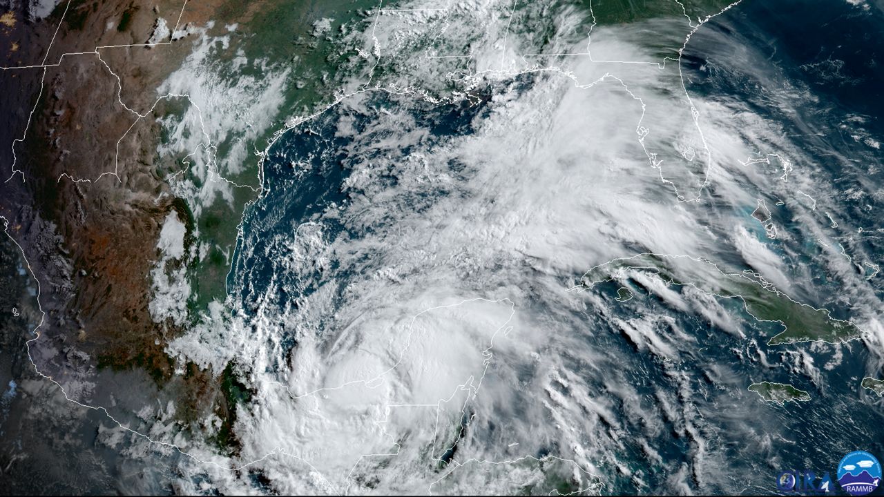
ST. PETERSBURG, Fla. — Cristobal continues to weaken as it has been over land for about 24 hours and the cloud pattern is not impressive.
All warnings for Mexico are canceled.
What You Need To Know
- TS Cristobal weakens
- Deep moisture will lead to high rain chances in Florida through weekend
- BN9 Tropical Update
Assuming the center will emerge over the Gulf of Mexico in about 35 hours, re-intensification should begin by tomorrow evening. Conditions over the Gulf of Mexico are not excepted to be favorable for development because of wind shear and dry air moving in from the west.
Intensity models are not bullish on development.
Models indicate Cristobal’s wind field will expand as the system moves into the Gulf of Mexico so the size of the wind radii have been increased in an eastern semicircle in 36-72 hours.

Meanwhile, deep moisture will lead to high rain chances in Florida through the weekend and a Flood Watch is in effect for most of the Tampa Bay region through Saturday.
We also will have to watch for deteriorating boating and beach conditions in our area depending on the future track of Cristobal.