


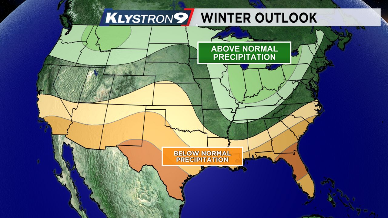
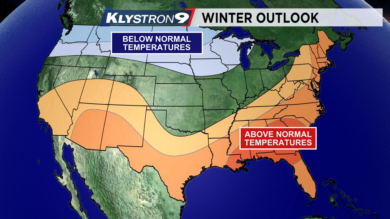
The Climate Prediction Center released its outlook for the upcoming winter and it calls for warmer than normal temperatures and below normal rainfall across all of Florida.
What You Need To Know
- Warm days are forecast to outnumber cooler days
- Rainfall will likely stay below normal
- The main storm track stays north
- A few chilly nights are still likely
The reasoning behind this year’s winter outlook comes from conditions in the equatorial region of the Pacific Ocean, where water temperatures have been cooler than normal. This is known as La Niña.
Cooler than normal water temperatures in the Equatorial Pacific can have an impact on the track of weather systems over North America. In a La Nina pattern, the jet stream tends to set up far to the north of Florida.
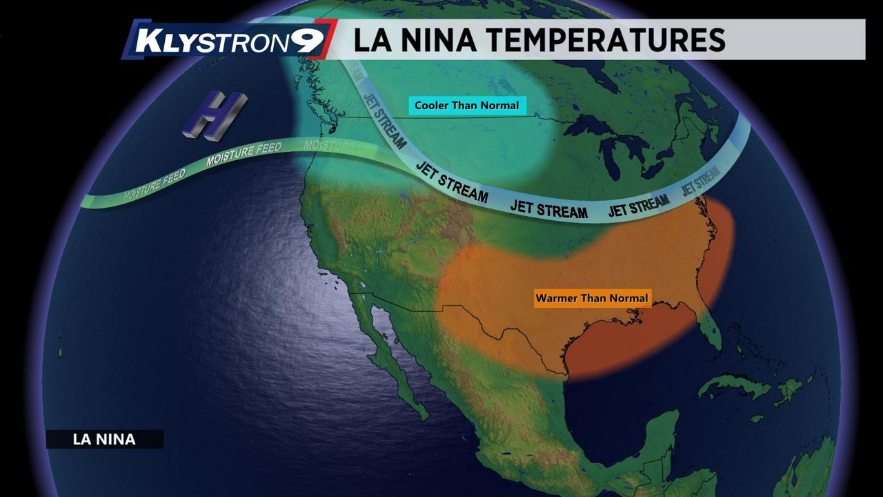
The jet stream is a narrow band of upper level winds that serves as the main pathway for storms to travel. It also separates colder air to the north and warmer air to the south.
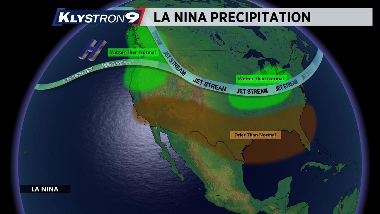
With the jet stream well to the north of Florida, it is likely that most of this winter’s precipitation misses us to the north, along with Arctic cold blasts.
This is why we expect temperatures to average out above normal throughout the winter, with below normal rainfall. See the outlook maps from the Climate Prediction Center below.
However, this does not mean every day will be warm and dry. The jet stream goes through different phases in the winter and can dip down to as far south as Florida, even in warmer than normal winters.
It is common to see at least a few freezes each winter in our Nature Coast counties. While it is likely that we will see the warm days outnumber cool days, don’t be shocked if we see brief cool spells behind a few cold fronts.
Our team of meteorologists dives deep into the science of weather and breaks down timely weather data and information. To view more weather and climate stories, check out our weather blogs section.