


ORLANDO, Fla. — We discussed in our last weather blog that this September went down as one of the driest and warmest September’s on record for Central Florida.
- Florida, Southeast has experienced abnormally warm, dry conditions
- Read more of Spectrum News 13's Weather Blog
- RELATED: September One of Driest, Warmest on Record
Well, it was not just Central Florida that experienced abnormally warm and dry conditions, but all of Florida and the Southeast U.S.
The latest climate summary for September came out this week for the entire U.S. It showed this September as the third warmest on record for Florida.
The average monthly temperature (including high and low temperatures) were nearly three degrees warmer than average.
When you break down the temperatures, highs were the third warmest on record and a little more than three degrees warmer than average.
Meanwhile, low temperatures finished as the fourth warmest on record for Florida. They were nearly three degrees warmer than average too.
Temperatures were so hot in September because there was less rain to cool the region down.
The dry air that dominated Florida after the passage of Dorian and Humberto, led to the state also experiencing its driest September on record.
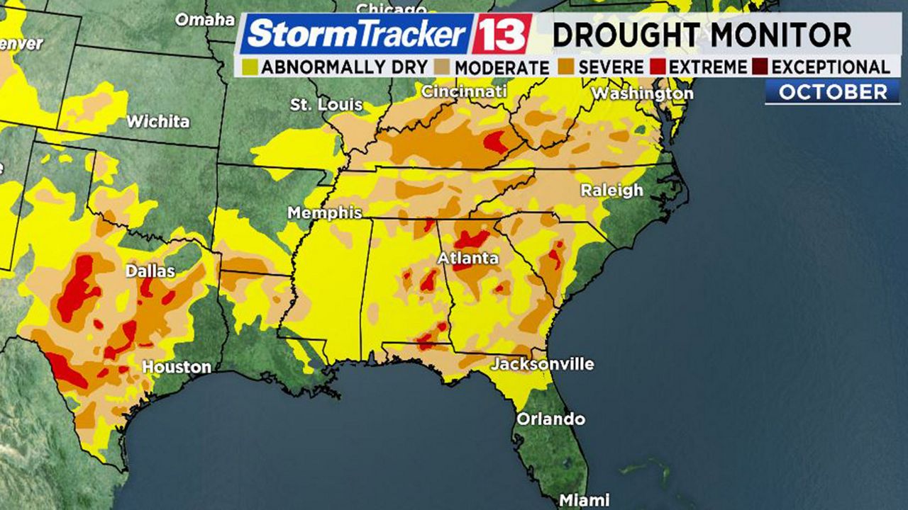
Drought conditions have been expanding across the Panhandle and in northern Florida. Abnormally dry conditions have moved into western Marion County.
It wasn’t only dry in Florida, but for all of the Southeast U.S.
Drought conditions have continued to grow in places like Alabama, Georgia and the Carolinas.
September was also the driest for the Southeast U.S. on record and the fourth warmest on record.
High temperatures were the third warmest and lows were the 10th warmest on record for the region.
You can see in the drought monitor just how much the drought has expanded and accelerated since May across the Southeast U.S.
Here's how the drought has expanded: