


Meteorologists are often criticized (we’ve all heard the "wish I could get paid to be wrong 50% of the time" joke) so it is nice to point out another success story and discuss the problems. As we say "Hind-casting is always 20/20" but it isn’t every easy when you are sitting in the hot seat and have to make a forecast day in and day out.
So that brings me to Hurricane Florence. Tropical forecasting is always tough due to the nature of the beast…tracking storms over the open ocean. The forecast for Florence was always going to be difficult because it fell into an unusual pattern that the computer models identified and gave guidance to the human forecasters who nailed the track forecast.
The track forecast could not have been more accurate as Florence came ashore within a couple of miles of the 5 day forecast point. Track forecasts have come a long way in the last 20 years, but we know there will always be challenges. For example, the track forecast just 18 hours before Irma impacted our area had the center going over Tampa Bay, when it actually went further east over Lakeland. There will always be difficult storms in challenging atmospheric environments that will test our abilities. But Florence was a good example of how far we’ve come.
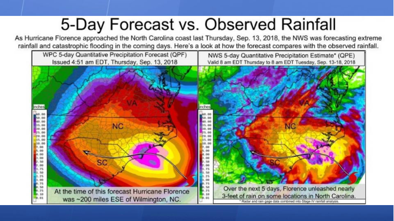
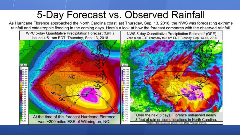
It is also important to get the impacts right. Florence wasn’t going to be a wind event but because of the approach to the coast and the long duration it was going to be a storm surge and heavy rain event. Here is the forecast of rainfall totals from the NWS and the verification of that forecast. No one in North Carolina should be able to say they didn’t know this was coming.
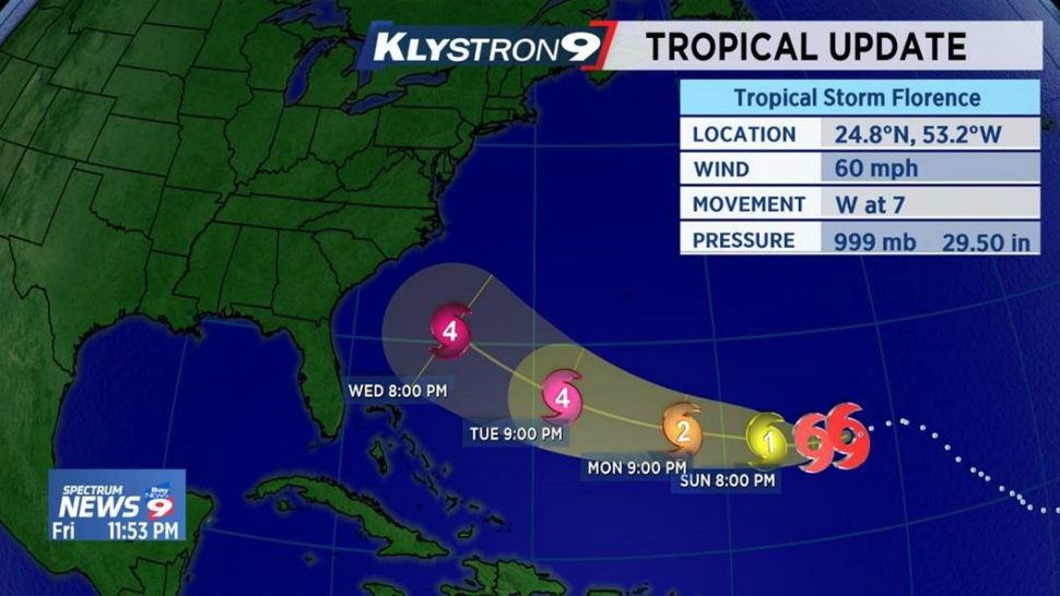
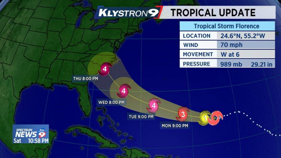
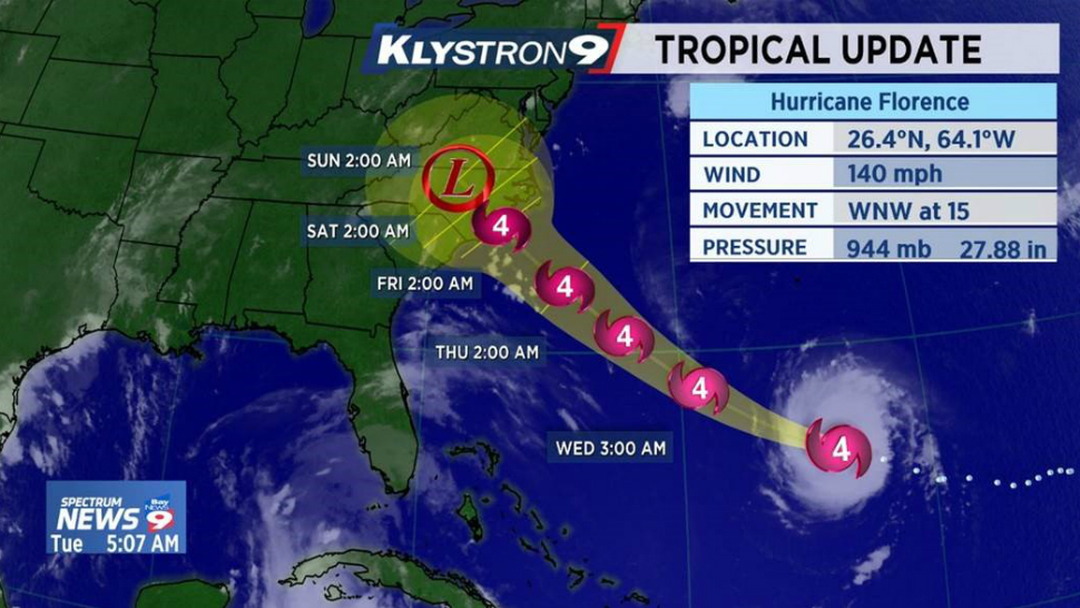
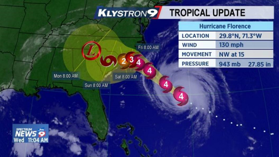
Now the problem, the intensity forecast. As I say in my hurricane talks, "don’t bet your life on decisions you make from a 48 hour intensity forecast, because we aren’t that good at it." The science of meteorology has a long way to go in hurricane intensity forecasting, I wish we didn’t show the forecast or the category on TV. I think it gives the false impression to the general public that we are better at it than we really are. Florence was a perfect example. As you might have noticed from the images above, Florence was forecast to be a major hurricane (category 4 actually) at landfall. Florence gave forecasters trouble from the start. It developed quicker than expected, then almost completely dissipated into an open wave, the before landfall it thankfully weakened to a category 1. Unfortunately, this gave some North Carolinians the impression that it wouldn’t be that bad, while meteorologists were warnings this would still be a catastrophic flooding event.
There was one shining moment in the intensity forecast. For the first time, NHC meteorologist were able to forecast "rapid intensification" while Florence was out at sea. This is big, since rapid intensification of a hurricane as it is about to make landfall can be very dangerous, especially to highly populated and difficult to evacuate areas such as Tampa Bay. Much research has been done in recent years to teach the computer models how to make forecast of rapid intensification. In Florence, the models were pretty much unanimous and the forecast of a tropical storm becoming a major hurricane in just 24 hours was made. It was correct.
So, every storm is different and hurricanes have many hazards from rain to wind to tornadoes to storm surge. They won’t all be victories there will be some setbacks as the atmosphere is a very complicated beast. But for a moment the men and women who "get paid to be wrong 50% of the time" are taking a bit of a victory lap with the job done during Florence.