


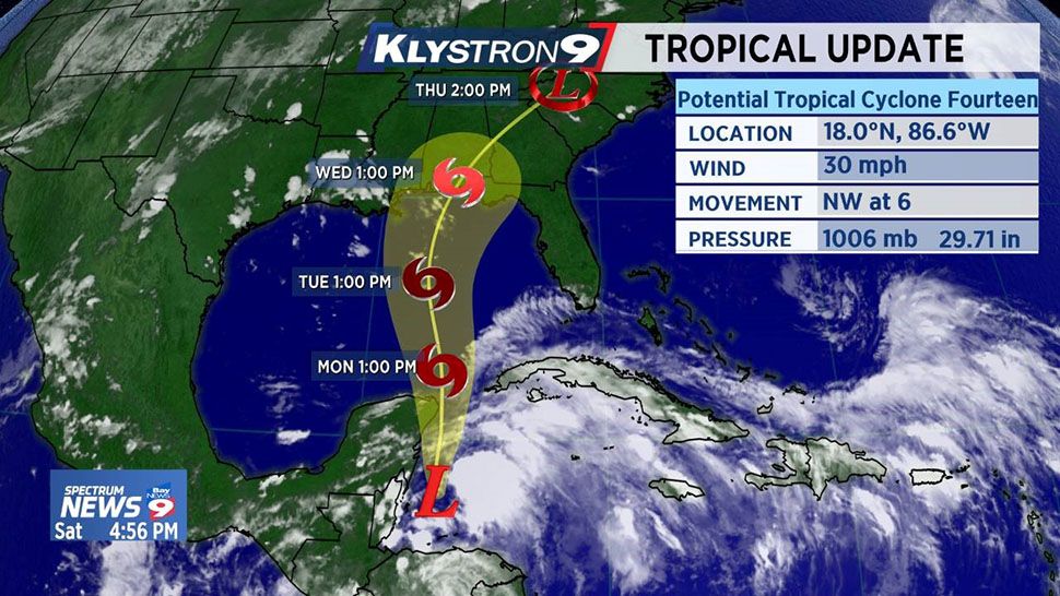
ST. PETERSBURG, Fla. — The area of disturbed weather in the Western Caribbean we have been watching is trying to close off into a low this afternoon. It is now considered Potential Tropical Cyclone 14.
- TRACKING THE TROPICS: Watches, warnings, forecasts, spaghetti models
- Watch our Tropics updates each hour at :49
A Potential Tropical Cyclone is an area of low pressure likely to develop into a tropical depression or tropical storm soon. It is issued when a system is developing near land and preparations will be needed quickly.
The wind shear in this area had been very strong over the last few days but conditions are expected to become gradually more conducive for further development, and a tropical depression or tropical storm is expected to form over the northwestern Caribbean Sea Sunday then move into the southern Gulf of Mexico on Sunday night or Monday.
Regardless of how much development, we can expect the moisture associated with this system to move into Florida next week. The models are in agreement that this system will make landfall anywhere from the Panhandle of Florida west to the coast of Southeastern Louisiana in the middle of the week. With the shear that this system will encounter, rapid intensification is not expected.
If it does become a tropical storm it will be Michael.

