


ST. PETERSBURG, Fla. — After we got through we wetter first half of May, we moved right into a typical late May weather pattern with dry air and warmer days.
- Bay Area experiencing dry air, warmer days
- More Weather Blog stories
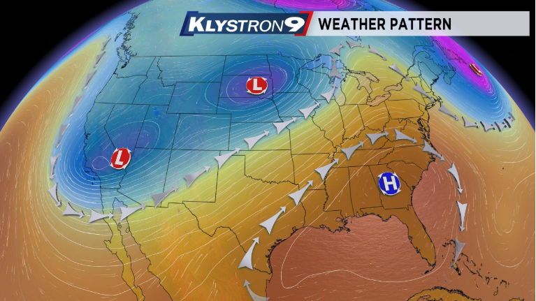
The wetter pattern across the country is very typical for this time of year, with active weather across the nation's heartland. There has been however, a larger area of cold air over the Western United States, and that has allowed our ridge of high pressure to develop.
This ridge is keeping any storm systems away and is also allowing us to warm up quite a bit.
With this pattern, and a lot of dry air aloft, rain chances remain very low. But, the same mechanism that generates our summer storms is also what is preventing many of us from seeing temperatures that are too warm.
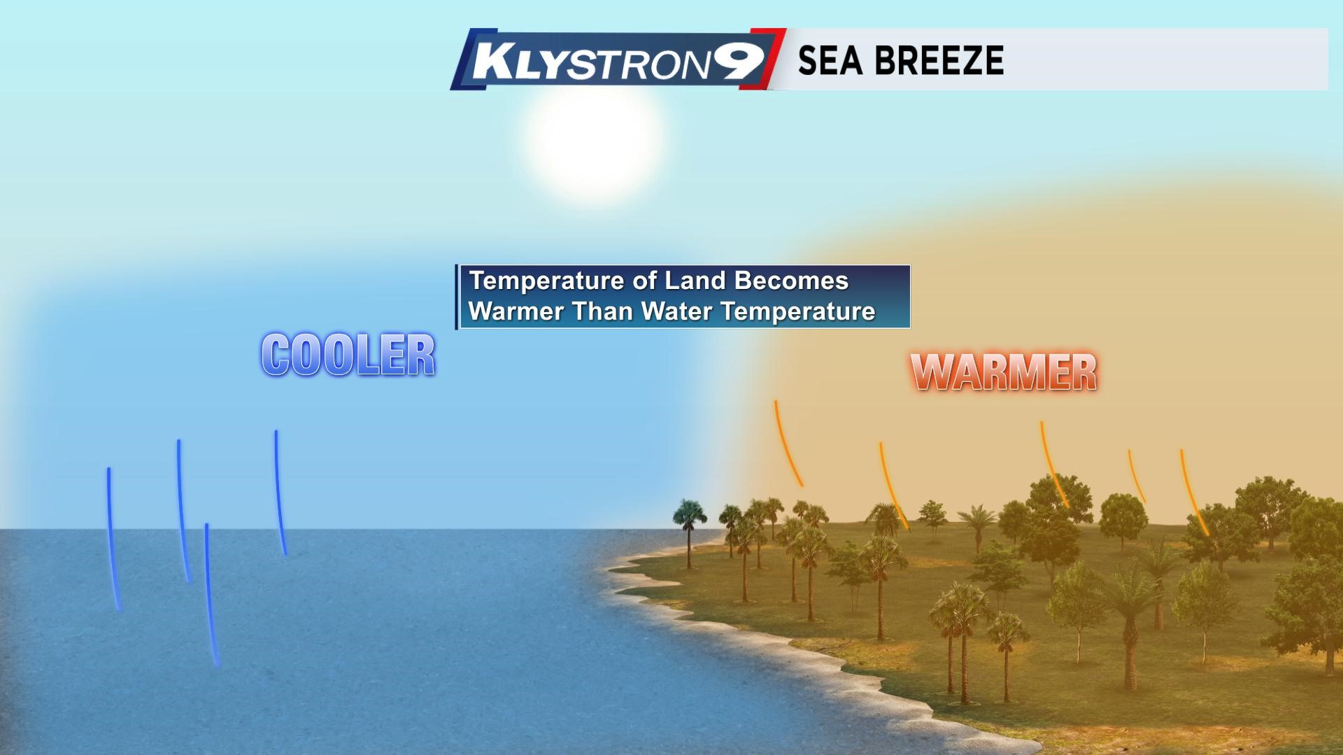
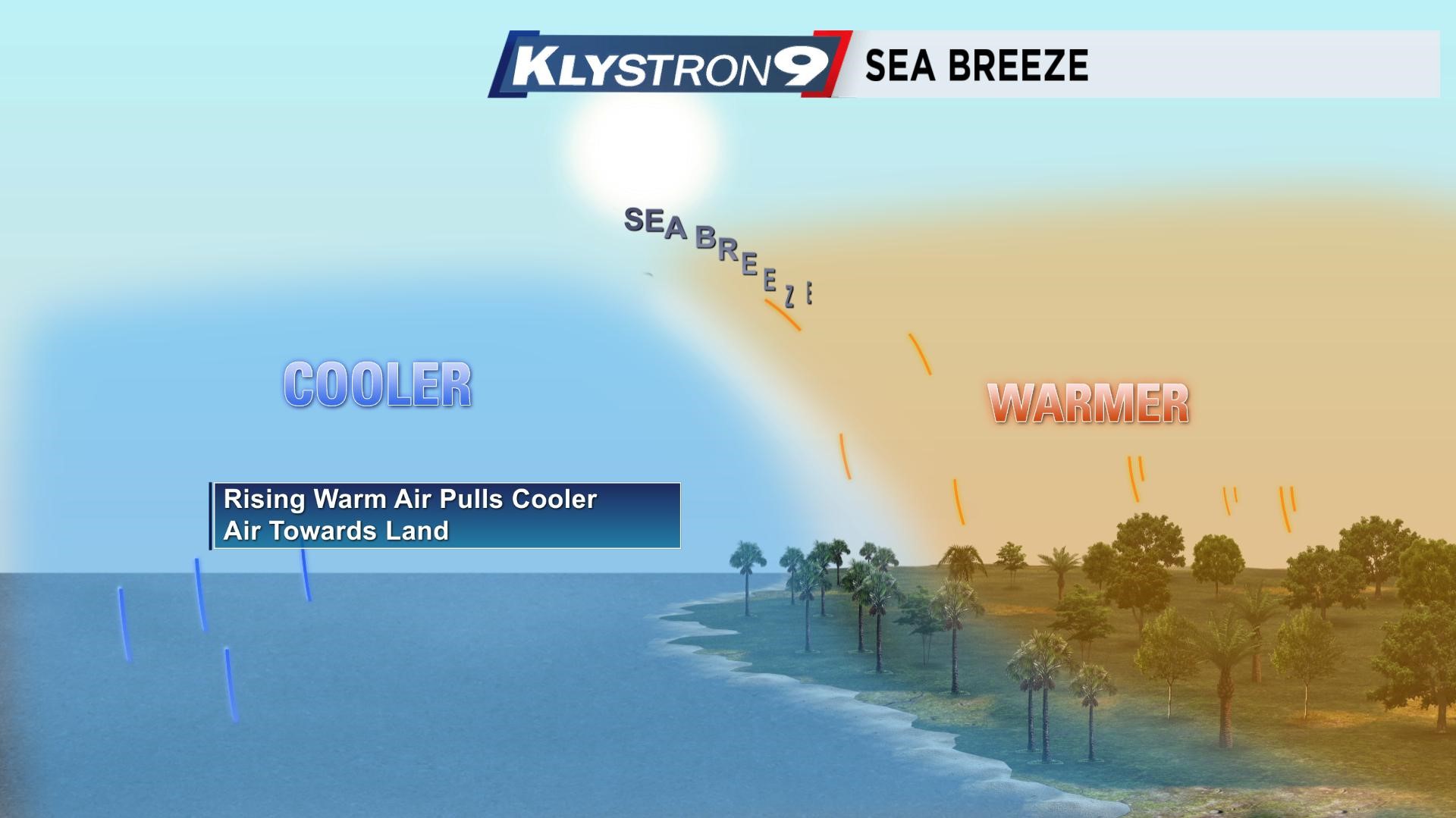
That is the sea breeze. The sea breeze forms because the land heats up faster than the water.
So, since the water temperatures are still in the low to mid 80s, when the land heats up more than that, there is a pressure differential, and that leads to a wind blowing from the higher pressure (over the cooler water) to the lower pressure (over the warmer land).
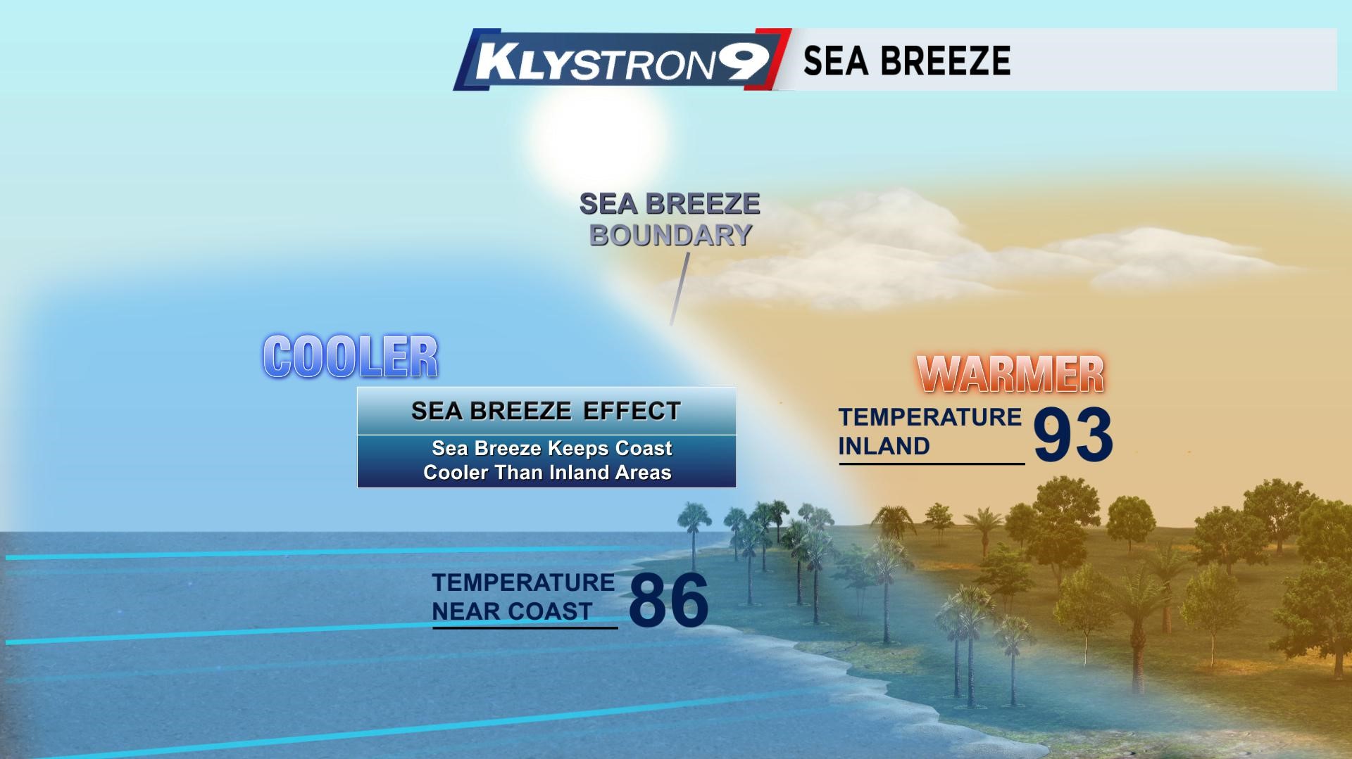
This is also one of the main reasons why Tampa has never hit 100 degrees. It is in this time of year when we can get pretty hot without the storms, but coming out of the Winter and Spring, the water temperatures haven't warmed up too much yet so the sea breeze forms pretty early in the day.
Sure, interior sections east of I-75 could get close to the century mark in this pattern, but this week and through the holiday weekend, the sea breeze will work to keep immediate coastal spots in the upper 80s and locations just inland may warm into the low to mid 90s before that sea breeze cools it.