


ST. PETERSBURG, Fla. — We are getting to the heart of the hurricane season, so it is no surprise that the Atlantic season is suddenly getting busy.
MORE FROM OUR WEATHER EXPERTS BLOG:
- WEATHER BLOG: Tampa Bay's Last 8 p.m. Sunset of 2019
- Today Marks 15 Years Since Hurricane Charley Devastated Florida
- WEATHER BLOG: NOAA Bumps Chances of Above-Average Hurricane Season
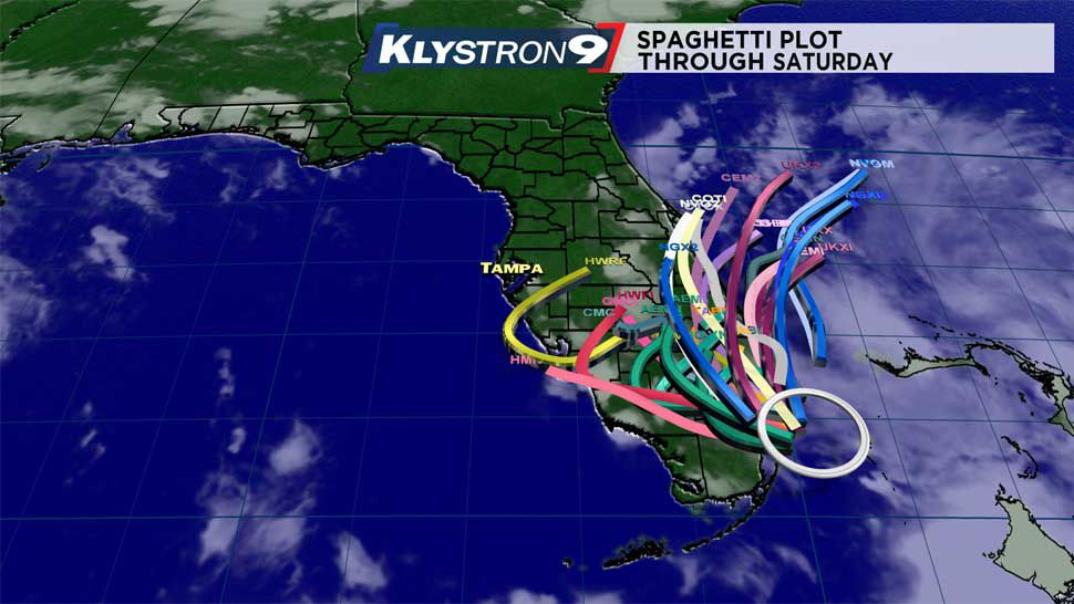
Right now we are watching a low pressure area over South Florida. It is over land, but embedded in deep moisture.
The models have started to come into better agreement on the forecast path. They are not showing any significant development of this system until at least Sunday, when it is back over the Atlantic.
The only impact on our forecast will be the lack of rain and our wind direction on Sunday.
Notice the models on the spaghetti plot. Even the models on the west side of the group keep the low southeast of Tampa Bay.
With all of these paths, the deepest moisture will stay off to our southeast, then south. When there is any tropical system just east of Florida, dry air on the west side of the system usually gets pushed into our area from the northeast.
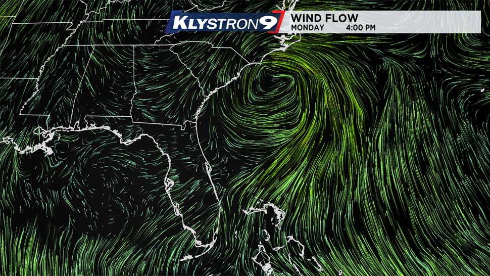
So our latest local forecast now calls for low rain chances for Saturday and Sunday. Originally, it appeared that Sunday would bring a westerly, onshore wind.
Now with this system expected to be in the Atlantic, local winds will be northerly, so any storms that develop will likely move in from the northeast.
The onshore winds that we have been talking about will materialize from Monday into Tuesday, after this tropical system moves well east of the U.S. coast. So again, the only impact this system will have on our forecast is the lower chance of rain in the Tampa Bay area. We will not see any increased winds this weekend.
The next system we are watching is in the Atlantic, over 1,000 miles east of the Windward Islands. This system may develop.
It will slowly move west toward the Caribbean, and may not get there until Wednesday or Thursday. It will then run into shear and dry air and may not survive beyond that time.
So stay tuned for the Tropical Update at :49 past the hour every hour through the rest of the hurricane season. You will always know when something develops and if a forecast changes!