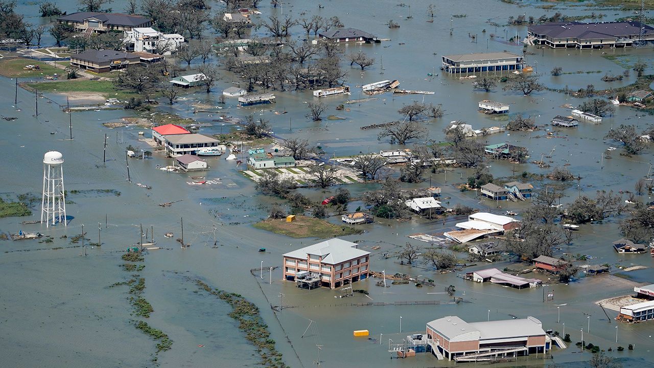
Laura made landfall over Cameron, Louisiana early on Thursday morning as a powerful Category 4 storm, making it one of the strongest hurricanes to make a U.S. landfall in recent memory.
Thursday's daylight started to show the damage coming out of the area. Fourteen deaths have been reported so far.
Despite Laura being a post-tropical cyclone now, the storm could still bring a flood, wind, and severe weather threat to parts of the Eastern Seaboard.
Laura officially made landfall as a high-end Category 4 hurricane at 1 a.m. CT on Thursday morning near Cameron, Louisiana, making it the strongest hurricane to make landfall on Louisiana since 1856.
Laura's maximum sustained winds were estimated to be 150 mph, putting the storm into rare territory in terms of landfalling U.S. hurricanes.
Wind speeds up to 127 mph were recorded in Cameron as Laura's northern eyewall moved through the city early on Thursday morning. Nearby Lake Charles, Louisiana recorded a wind gust of 133 mph on Thursday morning as well.
On Wednesday morning and ahead of the storm, the National Hurricane Center referred to the storm surge threat from Laura as "unsurvivable." Up to 20 feet of storm surge was expected to flood much of southwestern Louisiana and far southeastern Texas. The governors of both Lousiana and Texas preemptively declared disaster orders.
More than 650,000 people were without power on Friday.
Heavy rain spread far inland as Laura tracked north on Thursday. Parts of Louisiana received well over six inches of rain, while rainfall totals pushed four inches as far north as central Arkansas.
Aftermath of Hurricane Laura at a gas station in Lake Charles, LA.
Hurricane Laura Toppled second story of buildings in downtown Lake Charles, LA.
Since 1851, only 26 hurricanes of a Category 4 or 5 strength have made landfall on the continental United States. That means that a Category 4 or 5 landfall on the United States takes place only once every six or seven years.
Since 1851, Louisiana has had only three Category 4 hurricanes make landfall, according to Colorado State Univeristy hurricane researcher Dr. Phil Klotzbach.
No Category 5s on record have hit the state, according to Klotzbach.
Since 1894, Louisiana has only seen one Category 4 landfall, Hurricane Betsy back in 1965.
Laura tied for the strongest hurricane to make landfall in the state of Louisiana, alongside the Last Island hurricane of 1856. Klotzbach also noted that Laura is the strongest August Gulf of Mexico hurricane since Hurricane Katrina in 2005.
Laura became the earliest "L" named storm to ever form in the Atlantic, and an M-named storm had never formed in the month of August in the Atlantic before Marco.
These storms follow what has already been a record-setting season in the Atlantic.
With 13 storms already this year, this is the fastest start to an Atlantic hurricane season in recorded history. This is also the most Atlantic named storms on record to make landfall in the continental US by the end of August. Laura was the seventh storm.
As Laura continues on, here are five things you might not know about hurricanes.
The climatological peak of hurricane season is in mid-September. We're watching two disturbances in the Atlantic that have a chance of developing in the next five days.
If they do develop, the next names on our list are Nana and Omar.


