


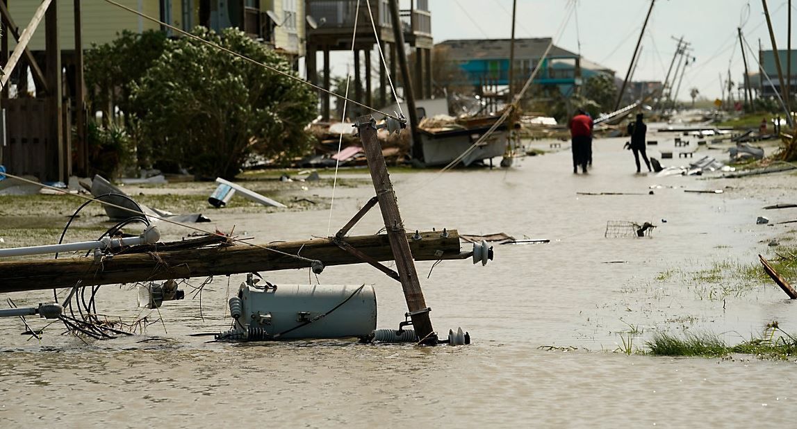
Hurricane Laura made landfall Thursday morning as a powerful Category 4 hurricane. Its winds were estimated at 150 mph when it made landfall in Cameron, Louisiana.
It struck within one nautical mile of the forecast point predicted 3.5 days ago.
Hurricane Laura was the first Category 4 or 5 hurricane to ever strike southwest Louisiana in recorded history. The records date back to 1851.
Tropical Storm Laura formed on August 21 near the Windward Islands. Initial forecasts were to take Laura through the northern Caribbean and pass dangerously close to the south Florida coast.
Obviously this didn’t happen and the forecast error was quite significant five days out. However, the track on future Hurricane Laura became more clear two days later when its center was passing just south of Cuba.
On August 24, the first round of hurricane watches was posted for parts of the northern Gulf Coast. The forecast called for a landfall over southwestern Louisiana, near Cameron.
Just three days later, Hurricane Laura made landfall as a major hurricane near Cameron, Louisiana.
A tweet put out by Plymouth State University Meteorology Professor, Jay Cordeira, said “NHC’s 3.5-day forecast for #Laura landfall was off by ~1km.”
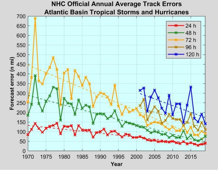
To put it simply, a one kilometer forecast error is remarkable especially when the average forecast error three days out is nearly 100 miles. Hurricane Laura made landfall within one nautical mile away from the predicted landfall point.
Hurricane forecast track error has improved significantly over the past 50 years. The average track error for one day out is 50 nautical miles. This is nearly half the error compared to that in 1970.
With the technology we have today, the average forecast track error three days out is just less than 100 miles. In the 1970s, the average three-day track error was greater than 400 miles! Remember, Hurricane Laura’s forecast error was nearly zero three days out.
So while forecasting the track of tropical cyclones has improved considerably over the past 40 years, the intensity forecasting still has a long way to go. This is especially true when it comes to rapid intensification with tropical cyclones, and that is what happened with Hurricane Laura.
The width of a forecast cone for tropical cyclones utilize average track error from one to five days out. You can read more about "Understanding The Cone" here.