


)
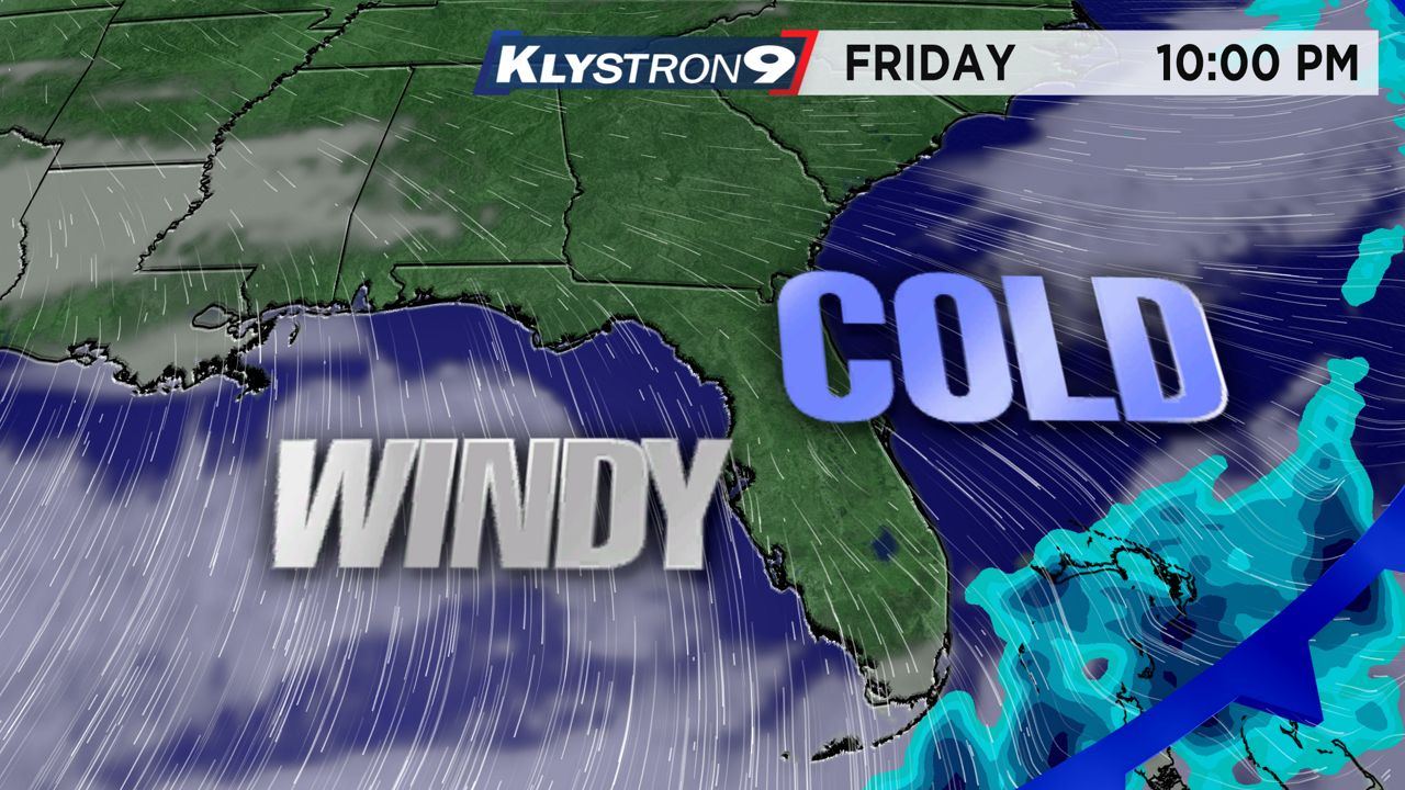
A strong cold front will come through on Friday and bring in some frigid air this weekend.
What You Need To Know
- Freeze advisories are in effect
- A freeze is likely all areas away from the water
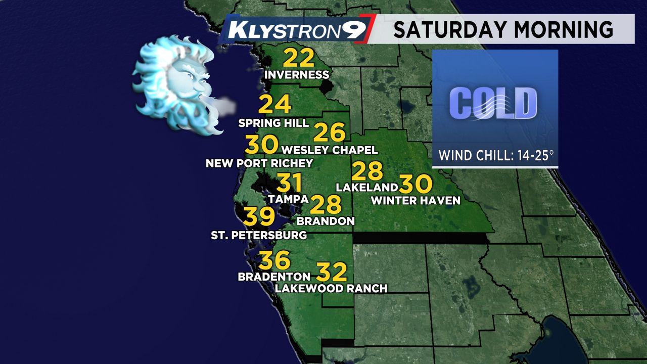
- 20s are likely in Levy, Citrus, Hernando, Pasco, Eastern Hillsborough and Polk counties
- It will be the coldest Christmas in 27 years
- Check out past Christmas temperatures
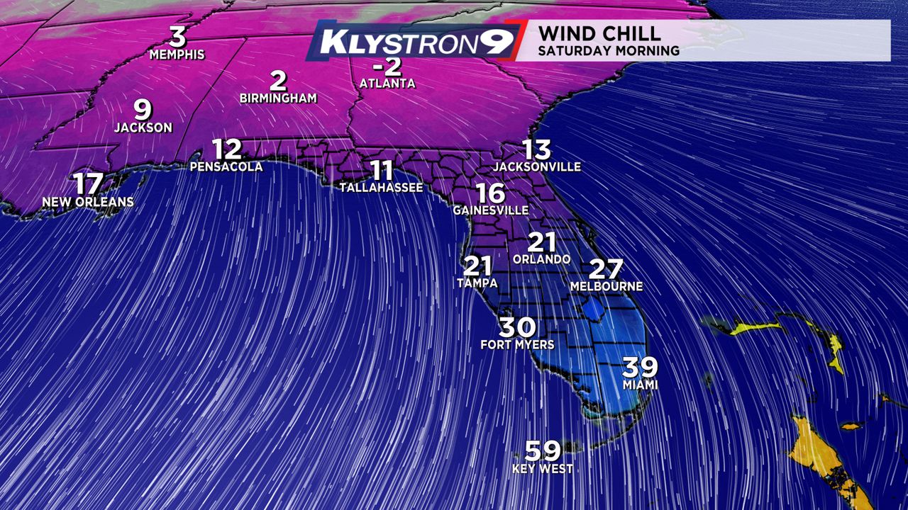
Temperatures will quickly fall Friday afternoon and evening, with low temperatures on Saturday morning near freezing for Tampa. This will be the coldest air we have seen in nearly five years.
A Hard Freeze Watch is in effect for Levy, Citrus, Hernando and Pasco counties.
A Freeze Watch is in effect for Hillsborough, Polk and Manatee counties.
Both of these will be upgraded to warnings soon. There will be freezing temperatures likely in northern Pinellas County also, even though you're not officially included in the advisories.
The last time we saw a temperature below 36 degrees at the Tampa International Airport was Jan. 18, 2018.
For Christmas specifically, the last time we saw a low temperature below 43 degrees in Tampa was 1995.
We could see low to mid-20s on Saturday and Sunday morning in Citrus and Hernando Counties. A freeze is likely for inland Hillsborough and Pasco Counties both mornings.
You should cover or bring inside sensitive vegetation over the weekend. Also, it may be a good idea to let your faucets drip at night.
High temperatures will barely make 50 degrees on Saturday and Sunday, especially north of Tampa. It will feel even colder when you factor in the wind.
Temperatures will gradually warm up Monday and Tuesday, but we will still be well below normal. We could be back in the 70s for highs by Thursday of next week.