


ST. PETERSBURG, Fla. -- Here's your Tampa area weather forecast for late Friday into Saturday morning, along with a look at conditions throughout the weekend.
- East wind
- Fewer storms
- Hotter temperatures
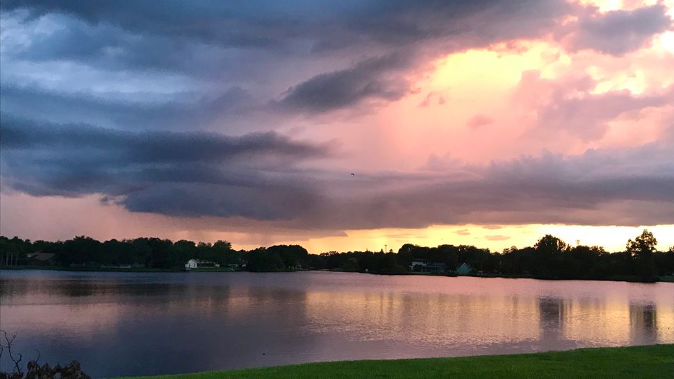
The few storms we saw tonight were in coastal areas and moved west into the Gulf of Mexico. Skies will go mostly clear into Saturday morning with lows in the low to mid 70s.
Most of Saturday will be sunny and dry, but late in the day there will be a few scattered storms, mainly in coastal regions, that will then move west into the gulf. Since most of the day will be dry it will be hotter with highs in the mid 90s.
The coverage of storms will be lower, only in the 20 to 30 percent range.
After the storms move into the gulf the rest of the night will be quiet, with lows in the low to mid 70s.
- WEATHER ON THE GO: Download the Spectrum Bay News 9 app and get Klystron 9 alerts wherever you are.
- GET WEATHER ALERTS: Sign up to receive weather text alerts from Spectrum Bay News 9
- Klystron 9 | 7-Day forecast | Tampa Bay-area temperatures | Travel weather
Sunday will be very similar, with a big chunk of the day staying dry.
The main difference will be that when the late day storms form in the coastal regions, there will be more of them. The coverage will be up to 40 percent.
Highs will again be in the mid 90s Sunday.
24-hour rainfall totals in inches (through 10 a.m. Friday)
Apollo Beach (Hillsborough) 2.86
Lakeland (Polk) 2.41
Crystal River (Citrus) 2.16
Plant City (Hillsborough) 1.98
Hernando (Citrus) 1.93
Thonotosassa (Hillsborough) 1.85
Spring Hill (Hernando) 1.71
Palm Harbor (Pinellas) 1.70
Riverview (Hillsborough) 1.67
Lutz (Hillsborough) 1.60
Tampa (Hillsborough) 1.40
Land O' Lakes (Pasco) 1.30
Hernando Beach (Hernando) 1.24
Zephyrhills (Pasco) 1.13
Port Richey (Pasco) 1.13
Weeki Wachee (Hernando) 1.06
St. Petersburg (Pinellas) 1.00
South Pasadena (Pinellas) 0.98
FLOOD WARNINGS
Flood Warning extended until Sunday morning
The Flood Warning continues for:
The Manatee River Near Myakka Head
- Until late Saturday night.
- At 7 p.m. Friday the stage was 13.4 feet.
- Minor flooding is occurring and Minor flooding is forecast.
- Flood stage is 11.0 feet.
- The river is expected to fall below flood stage by tomorrow evening.
- Impact...at 11.0 feet...Private road and bridge 1 mile downstream flood. Agricultural, rural Kibler area begins to flood.
The Flood Warning continues for
The Cypress Creek At Worthington Gardens
- Until further notice.
- At 8 p.m. Friday the stage was 11.1 feet.
- Moderate flooding is occurring and Moderate flooding is forecast.
- Flood stage is 8.0 feet.
- The river will continue rising to near 11.2 feet by Sunday morning, then begin falling.
- Impact...at 11.0 feet...Flooding threatens two homes on State Road 54.
The Flood Warning continues for
The Alafia River At Lithia
- Until Monday evening.
- At 8 p.m. Friday the stage was 14.2 feet.
- Minor flooding is occurring and Minor flooding is forecast.
- Flood stage is 13.0 feet.
- The river will continue rising to near 14.3 feet by early tomorrow morning. The river is expected to fall below flood stage Monday early afternoon.
- Impact...at 15.0 feet...Additional residences downstream of County Road 640 bridge begin flooding.
Flood Warning extended until Saturday morning
The Flood Warning continues for:
The Myakka River At Myakka River State Park
- Until Wednesday afternoon.
- At 8 p.m. Friday the stage was 7.1 feet.
- Minor flooding is occurring and Minor flooding is forecast.
- Flood stage is 7.0 feet.
- The river will continue rising to near 7.3 feet by Sunday evening.
- The river is expected to fall below flood stage Wednesday morning.
- Impact...at 7.0 feet...Trails, picnic areas, and parking lots at Myakka State Park flood.
Flood Warning extended until Monday afternoon
The Flood Warning continues for:
The Peace River At Bartow
- From tomorrow evening through late Sunday night.
- At 8 p.m. Friday the stage was 7.9 feet.
- Minor flooding is forecast.
- Flood stage is 8.0 feet.
- The river is forecast to rise above flood stage by tomorrow evening and continue to rise to near 8.0 feet by Sunday morning. The river is expected to fall below flood stage by Sunday evening.
- Impact...at 8.0 feet...Private roads downstream flood.
7-day forecast
