


ST. PETERSBURG, Fla. -- For the 2018 Hurricane Season, a product that was in the "test" phase last year will become fully operational this season.
- New forecast products as hurricane seasonarrives
- Tropical storm force winds and time of arrival forecasts
- Storm Season 2018
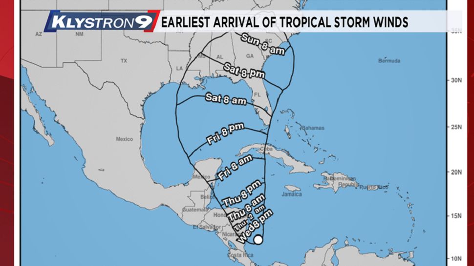
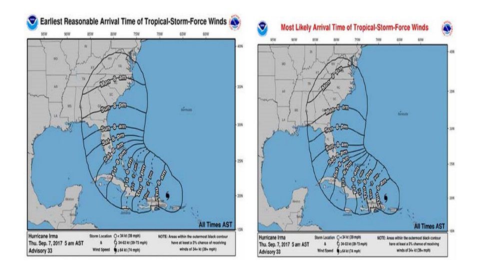
This is the earliest arrival of tropical storm force winds and the most likely arrival of tropical storm force winds.
The arrival of sustained tropical-storm-force winds is a critical threshold as many preparedness activities become difficult or dangerous once winds reach tropical storm force.
To help you know when activities outdoors should be completed before a storm, NHC began issuing experimental Time of Arrival of Tropical-Storm-Force Winds graphics in 2017.
These graphics will become operational in 2018. The graphics are driven by a wind speed probability model that is currently used to determine the risk of tropical-storm and hurricane-force winds at individual locations.
A model in which 1000 plausible scenarios are constructed using the official tropical forecast and its historical errors.
The "earliest reasonable" arrival time is the time that has no more than a 10 percent chance of seeing the onset of sustained tropical-storm-force winds: the period during which preparations should ideally be completed.
A second graphic will show the "most likely" arrival time: that is, the time which the onset of tropical-storm-force winds is likely.
This graphic would be more appropriate for users who are willing to risk not having completed their preparations before the storm arrives.
We felt these graphics worked well in 2017, hopefully there will be no need to use them in the coming years but if there is we will provide them on air and on-line.