


Researchers at Colorado State University released their preseasonal Atlantic hurricane season forecast Thursday morning, calling for another active year across the Atlantic basin.
The report, released at the National Tropical Weather Conference in Texas, highlights several factors for the upcoming season which lead researchers to believe the Atlantic will be as alive as ever.
The forecast calls for 23 named storms this season. Of those 23 storms, 11 are expected to become hurricanes and five are expected to reach major hurricane strength with winds of 111 miles per hour or greater.
- Who names tropical storms, and can I get one named for me?
- The history of naming tropical cyclones
- 5 things you may not know about hurricanes
- Why hurricanes form and why they're necessary
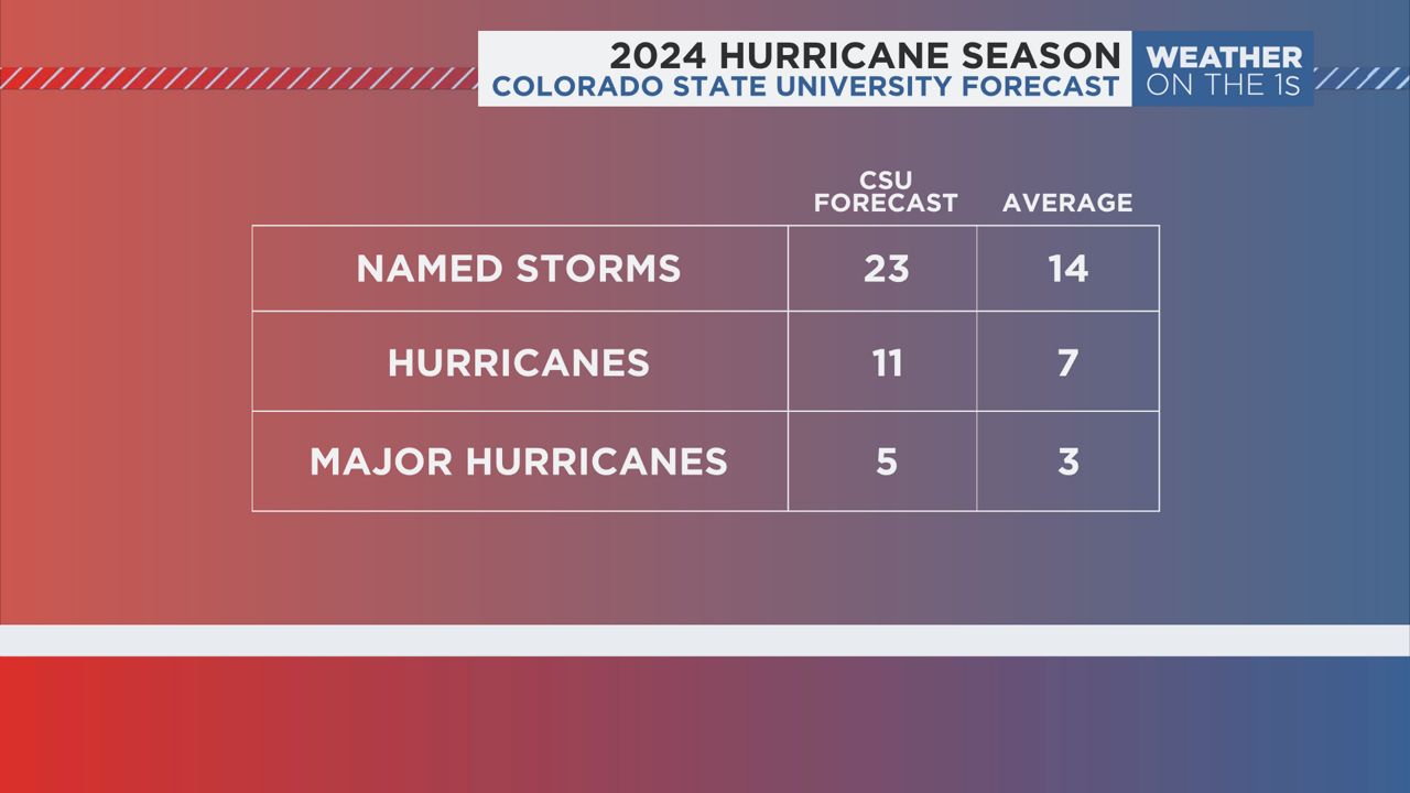
This is the most aggressive preseason forecast Colorado State University has ever issued. The previous record for highest preseason forecast called for nine hurricanes in a season, which CSU has forecast several times since their first April predictions began in 1995.
The researchers cite record warm tropical and eastern Atlantic sea surface temperatures being a primary factor in the hurricane prediction this year.
"When waters in the eastern and central tropical and subtropical Atlantic are much warmer than normal in the spring, this tends to force a weaker subtropical high and associated weaker winds blowing across the tropical Atlantic," the report states. "A very warm Atlantic favors an above-average season, since a hurricane’s fuel source is warm ocean water."
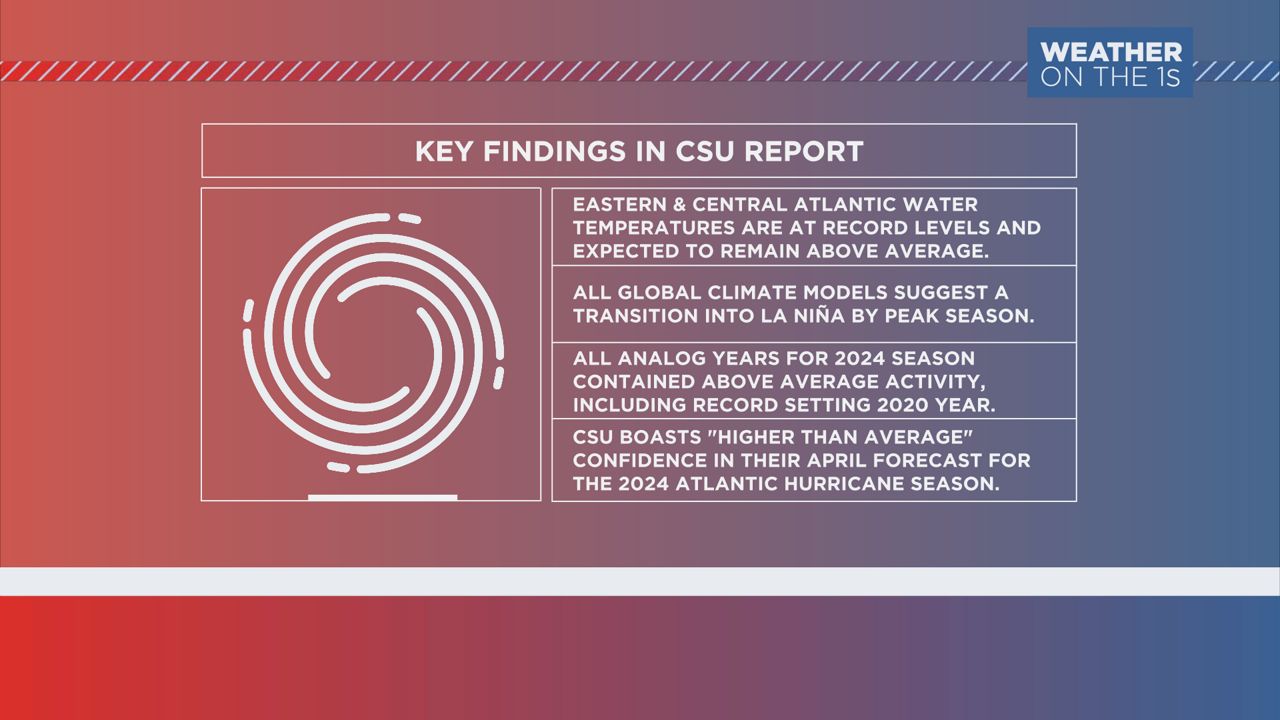
Additionally, warmer sea surface temperatures promote larger areas of rising air, which promotes storm development. This can also lead to more favorable conditions for hurricane development as a season moves on.
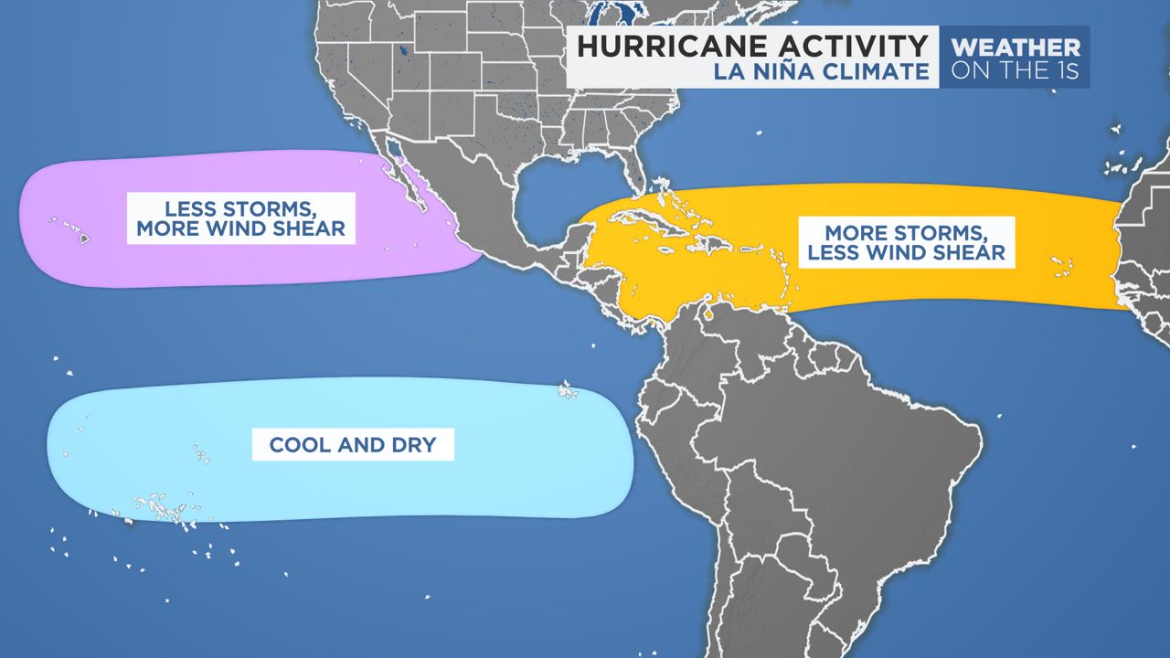
But that's not the only factor leading researchers to believe the season this year will be more active than usual. A changing global climate pattern known as the El Niño Southern Oscillation (ENSO) will help spark lower wind shear across the Atlantic basin, likely bringing a more favorable environment for storms to thrive as we head toward the peak season in August and September.
"The tropical Pacific is currently characterized by weak El Niño conditions. These El Niño conditions are likely to transition to neutral ENSO conditions in the next few weeks and then to La Niña conditions by the peak of the Atlantic hurricane season," the report states. "La Niña typically increases Atlantic hurricane activity through decreases in vertical wind shear."
Historically, ENSO forecasting during the spring months can be filled with some questions. Global climate models struggle with capturing the full extent of how the atmosphere can transition heading into summer. But CSU says this year's climate forecast brings some unusual confidence.
"All models are forecasting El Niño to be gone, with most models forecasting La Niña to develop by the peak of the Atlantic hurricane season," they say.
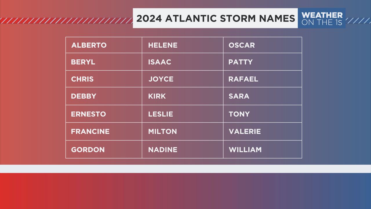
The Atlantic Hurricane Season runs a name list that's 21 names long. Colorado State University is outright forecasting that the season will run out of names by Nov. 30. If that becomes the case, the basin will move to a secondary name list for the first time since its inception in 2021. Before 2021, any storms that formed after the 21st went in order of the Greek Alphabet. That has only occurred twice in recorded history — 2005 and 2020.
In total, CSU predicts that hurricane activity in the Atlantic basin this year will be about 170% of an average season. Last year, hurricane activity in the Atlantic basin tracked about 120% of an average season.
Colorado State will issue forecast updates to its seasonal predictions on June 11, July 9 and Aug. 6 of this year.
Our team of meteorologists dives deep into the science of weather and breaks down timely weather data and information. To view more weather and climate stories, check out our weather blogs section.