


ST. PETERSBURG, Fla. — We have had some active weather over the last few weeks with potent Winter storm systems about every 5-7 days. Each one has been unique but has had some similar characteristics.
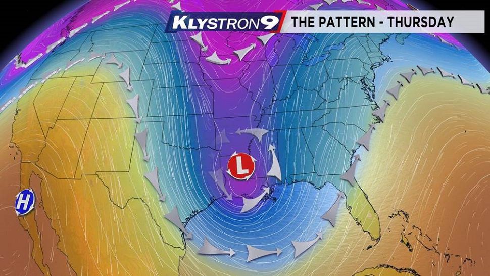
Our latest threat will be based on a strong upper level low pressure area that by Thursday will be sitting over the Lower Mississippi River area.
The low level jet stream will be active from the south Southwest ahead of that low. That will bring lots of deep moisture into our area. This set up will lead to more widespread rain, the threat for some strong to severe thunderstorms, and very windy conditions making for extremely dangerous boating and beach conditions and potential coastal flooding on Friday.
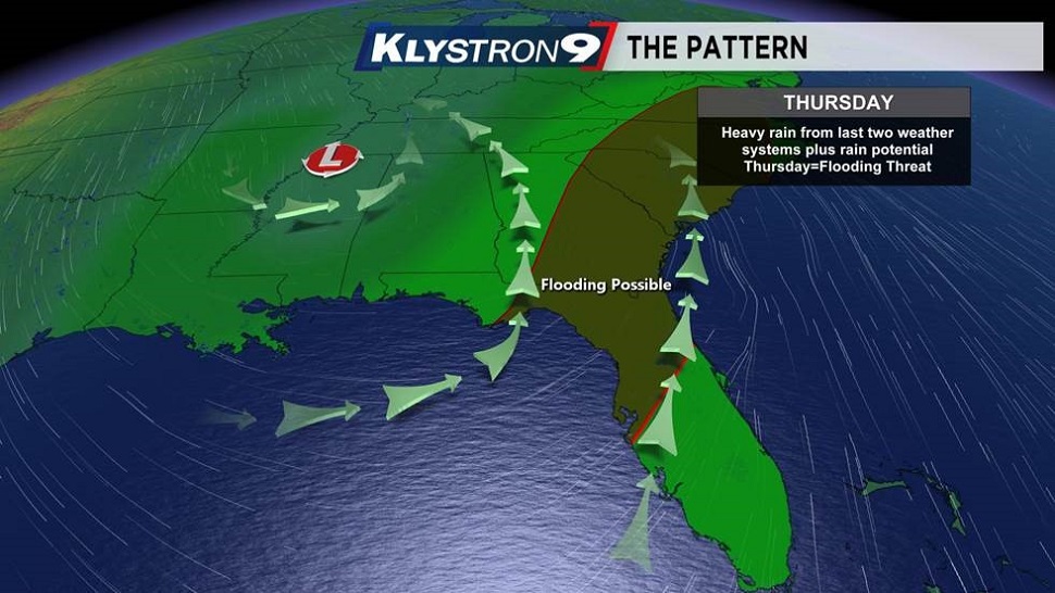
Our last storm system dumped over 4 inches of rain in many spots from Tampa Bay northward and this system has a similar potential as we will have rounds of rain beginning with Wednesday night.
Heavy showers are possible all across the area Thursday morning. This will occur even before the main line of strong thunderstorms moves through. Here is where there is some uncertainty….the strength of the thunderstorms. Do they go severe? The reason for the uncertainty will be actually due to the rain that precedes the storm line.
If enough rain falls for a long enough period of time, that may be just enough to stabilize the lower part of the atmosphere, limiting our chances for stronger or severe storms. If we get a break from the rain during the mid morning, combine that with the strong wind from the south at the surface, then that warm, moist air mass will feed into the line of storms resulting in stronger thunderstorms. Right now, it looks more like the more stable scenario except for perhaps, south and east of Tampa Bay, where the potential for morning widespread rain is a little lower.
It is something we will watch very closely during the morning Thursday.
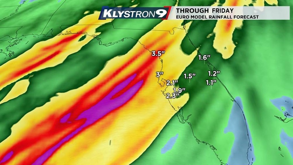
Regardless of the severe potential, we will be looking at widespread heavy rain totals between Wednesday night, Thursday and into Friday. Most computer models are in general agreement with a widespread 2 to 4 inch situation which would lead to flooding concerns over already saturated ground.
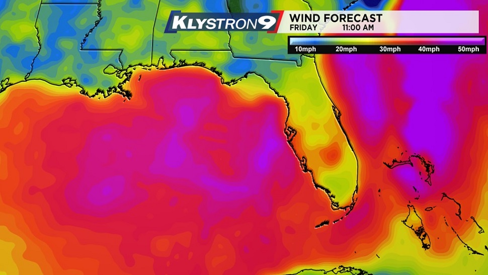
The next hazard will arrive Thursday night into Friday when the wind increases to gale force behind the front from the west. Winds will be in the 25-35 mph range with gusts over 40 mph throughout that time period. Since the wind will be from the west, there is the potential for some water rise, especially during the high tide times on Friday. Areas near the coast prone to flooding may see a 1 to 2 foot water rise. Additionally, those strong winds will make boating very dangerous so PLEASE DON’T GO OUT ON THE BOAT!
Finally, following Friday, colder and drier air will settle in for the weekend. But, don’t worry…..a Florida style Christmas is in the works with sunshine and temperatures in the 70s.