


Have you ever wondered what it would be like to forecast weather in Florida? While some may think adding "a chance of a shower or storm" to the forecast will get you by most days, it's more involved than that.
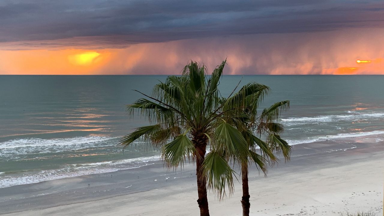
The rainy season in Tampa usually kicks into gear in early June and runs through early October. This is when Tampa Bay receives most of its annual rain and it usually comes from daily thunderstorms.
The phrase "partly cloudy with a chance of thunderstorms" is true just about any day during the rainy season, but the phrase alone doesn't do you any good with making plans. What if your plans take you to the beach for the afternoon or a fishing trip in the morning? Knowing what part of the day storms will move through can help with your decision-making.
Meteorologists closely study weather patterns in the areas they are responsible for. Recognizing common patterns can help a meteorologist determine how many storms are likely to form, who is likely to see storms and what time of the day storms are expected to develop.
Here are some of the patterns that affect Tampa Bay's weather each rainy season.
Most common pattern
This is the pattern that most often affects our weather during the rainy season. This is the pattern where a southeast wind flow results in several afternoon thunderstorms on the Gulf side of the Florida Peninsula. The rain chance is greatest along the I-75 corridor, whereas the storm chance is lowest along the I-95 corridor.
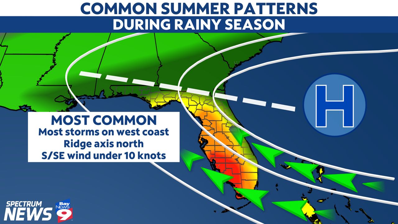
We see this pattern when high pressure is centered to our east and the ridge axis (white dashed line) extends west toward the Florida-Georgia line. During this setup, storms develop inland and become more numerous when they interact with the Gulf Coast sea breeze.
Tampa's wettest pattern
Also known as the "reverse summer pattern," meteorologists recognize this pattern when there is an onshore wind out of the southwest. This pattern usually results in the greatest rain chance for Tampa Bay with storms focused earlier in the day.
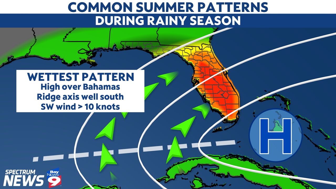
This pattern results when high pressure is located near the Bahamas with the ridge axis (white dashed line) extending west toward the Gulf of Mexico through the Straits of Florida.
An onshore wind transports copious amounts of moisture over our area from the Gulf Coast. Morning storms are often widespread before moving to the east. Although the "reverse summer pattern" tends to bring our greatest rain chance, our afternoons tend to be drier since most of the weather affects Florida's east coast during the afternoon.
Tampa's driest pattern
Our driest patterns are usually observed toward the start or end of the rainy season. The rain chance is not zero, but the focus of storms in this pattern is located over South Florida toward the Everglades.
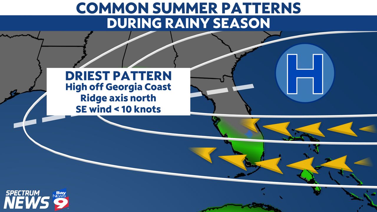
We tend to see this pattern when high pressure is located to the northeast with the ridge axis (white dashed line) extending west into the Gulf, but remaining north of Tampa Bay. The wind flow is out of the east southeast and the rain chances decrease as you go north.