


Exactly 20 years ago this week, we began weather surveillance of the skies within 300 miles of Tampa Bay with our first weather radar at Bay News 9.
Since I have been here from the launch of Bay News 9 in September 1997, I’ve been privileged to have witnessed and participated in these events to bring the best weather coverage to Tampa Bay over the last 20 years.
Although another TV station has been in the weather radar business longer, it was a significant feat for us, being a new cable only all-news channel, to purchase the best weather radar available at the time.
Our owners fully supported our efforts and it sure isn't cheap. Weather radars are expensive to buy and maintain.
We were already familiar with Baron Services (now Baron Weather) in Huntsville, Alabama. Baron (owned by former WFLA Chief Meteorologist from the 1980s, Bob Baron) was already a player in weather software.
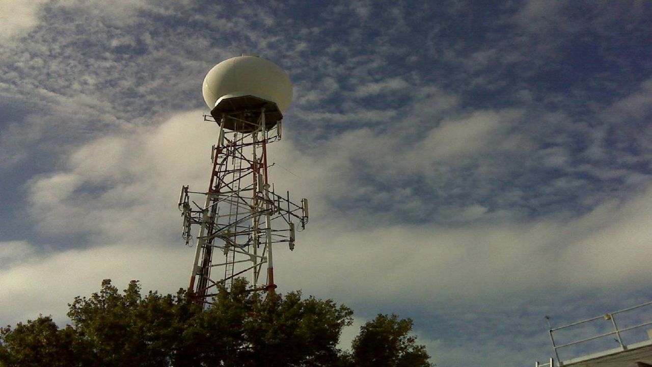
They wanted to be in the business of building radars. Jeff Piotrowski is the sales rep assigned to our part of the country, Jeff is still our rep today. Jeff and I stood outside our original studio in Pinellas Park and looked at a 100 foot cable communications tower already on site and unused.
We devised a plan to take the top section of the tower off and replace it with a radar dome. This would save us money since we didn’t have to build a new tower.
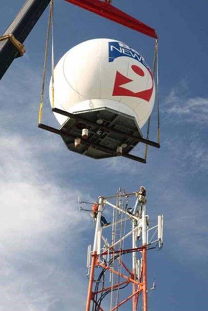
An engineering firm was hired to look at our plan and they quickly reported the tower could hold the radar with no problem. We knew we simply must have a good, LIVE, weather radar especially in Florida. We were in business!
We took delivery of a new Baron VHDD-350C (Very High Definition Doppler – 350,000 watts – C-Band) radar in a hot July of 2001. The crews had to work through the mix of our summer heat and daily storms. The radar began operation in a couple of weeks. We named it PINPOINT DOPPLER 9000.
It didn't take long before the radar was put to the test. Just a month later, rapidly strengthening Tropical Storm Gabriel hit Manatee and Southern Pinellas Counties hard.
I was able to use new radar techniques to say on the air that this tropical storm was as close to being a hurricane as you can get. Later, the National Hurricane Center said it may have indeed been a hurricane at landfall.
Pinpoint Doppler 9000 became a trusted tool for tracking weather during the active hurricane season of 2004.
In August, we picked up the eye of strengthening Hurricane Charley at 300 miles range. I knew there was trouble that morning when I could see the whole eye of Charley at 300 miles away, the maximum radar range.
Charley was quickly becoming a major hurricane.
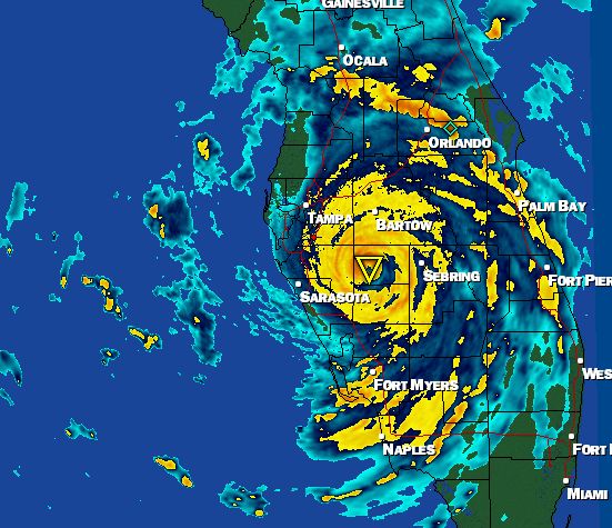
Using our radar’s display of the perfect eye, I simply put a circle around the eye every 30 minutes and could clearly show viewers how the eye was edging closer to the Southwest coast of Florida and would run into the coast later and hit well south of us.
Since the NWS Radar in Ruskin was down that morning as Charley approached (it was quickly repaired before landfall) we were glad we owned our own radar.
As Charley moved into Eastern Polk County that evening, Meteorologist Josh Linker was on the air showing very high winds as the eye moved toward Orlando.
We found out the next day that Charley was still doing “tornado-like” damage over Polk County and into Orlando before midnight. Pinpoint Doppler 9000 was a trusted tool for the rest of the season with Hurricanes Frances and Jeanne.
In 2005, we tracked the eye of Katrina across South Florida and into the Gulf on its way to New Orleans.
---COMING UP NEXT WEEK PART 2: KLYSTRON 9 ---