ST. PETERSBURG, Fla. — The tornado watch issued Tuesday morning for Southwest Florida counties now has expired.
The watch was in effect until 10 a.m.
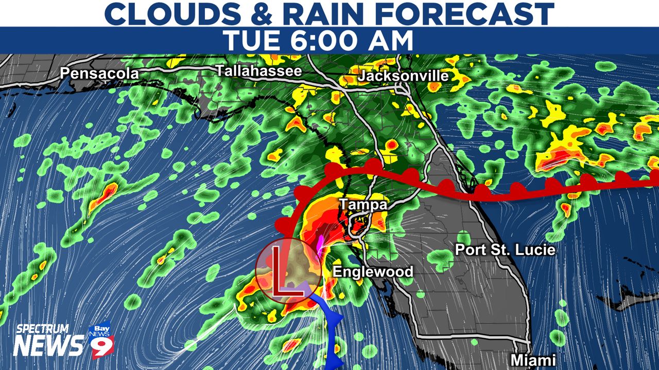
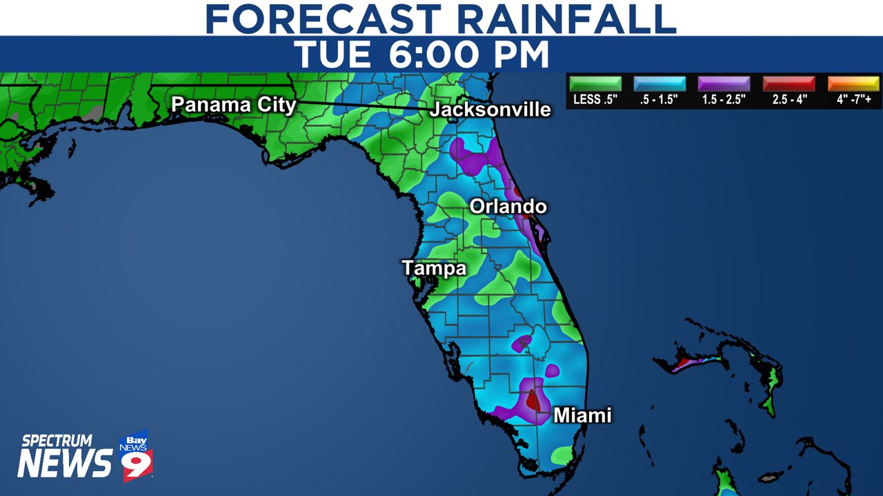
A strengthening area of low pressure over the Gulf of Mexico will cross the state on Tuesday. This will result in a warm front lifting north of Tampa early Tuesday morning. Anyone located south of the warm front will be at risk for severe weather.
There's still a question as to how far north the warm front will extend. This is important because it plays a significant role in who will be at risk for severe weather. At this time, areas along and south of I-4 will be most at risk for severe storms that may be capable of producing damaging wind gusts and perhaps an isolated tornado.
Here's what you can expect and when:
Through 5 a.m. Tuesday
A low off to the west will be nearing the Florida Gulf Coast. Areas of rain will increase in coverage with thunderstorms possible. A warm front will be lifting to the north at this time. Gusty south winds are possible.
Between 5 a.m. and noon Tuesday
This is the window for strong to severe thunderstorms. Parts of Tampa Bay will be positioned in what we call the "warm sector." This is the location between the warm front and cold front. This is where storms have the potential to produce high wind gusts and perhaps an isolated tornado.
Winds could gust in excess of 50 mph and isolated power outages will be possible. Boating will also become dangerous as seas are expected to build between 3 to 6 feet. A Small Craft Advisory is in effect for our coastal waters.
Tuesday afternoon
A cold front will swing through our entire region. Winds will shift out of the northwest with gusts near 30 mph through the afternoon. Additional showers and thunderstorms will be possible as the front swings through. Any chance for severe weather will end once the cold front passes by.
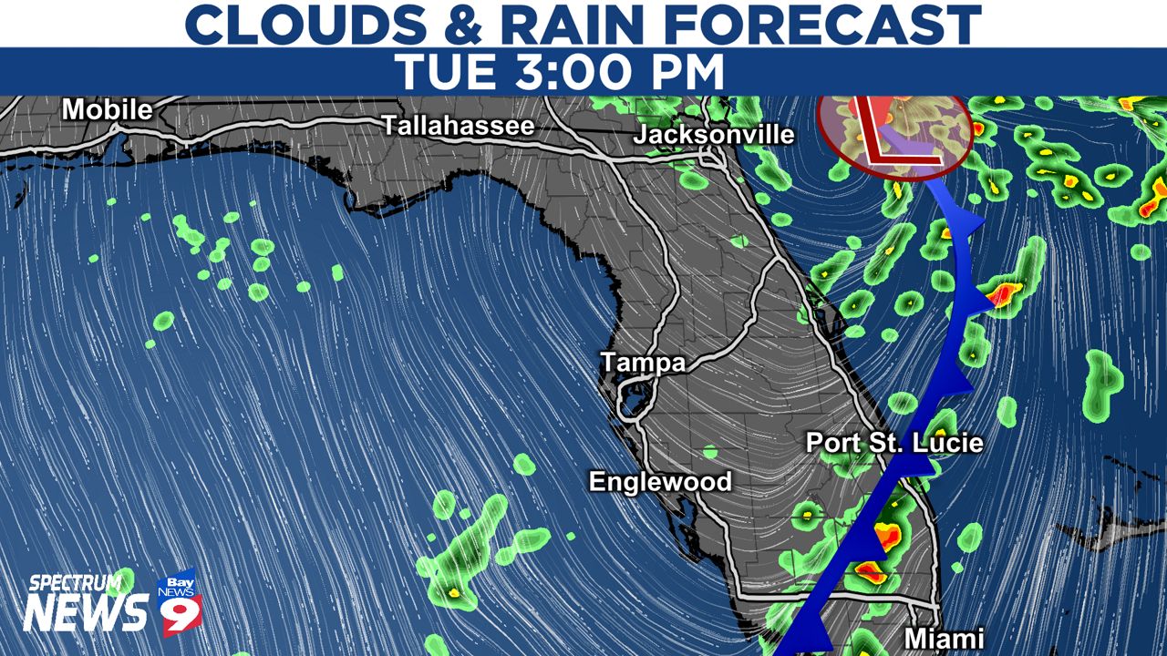
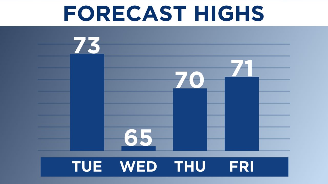
A cooler and drier air mass flows in behind the front. This means temperatures will gradually fall into the 60s Tuesday afternoon with decreasing clouds.
Boating will remain hazardous through the rest of the day with rough seas.
Wednesday
What a difference a day makes! Wednesday morning will start off breezy and chilly. Temperatures will dip into the 40s and 50s in the morning. Despite some sun Wednesday afternoon, high temperatures will be running cooler than average. High temperatures will run in the 60s during the day.