


Our weather will undergo rapid changes over the next 36 hours. Hazardous weather will start in the form of strong to severe storms followed by marine hazards, along with "winter weather" hazards going into Sunday.
We encourage anyone with plans this weekend to monitor the latest.
A strong cold front will move across the Bay area Saturday, bringing a hosts of hazards to the area this weekend. Conditions will change rapidly this weekend and it all kicks off with the chance for severe weather Saturday morning.
A squall line associated with the cold front will move in from the Gulf of Mexico. These storms will move in quickly and some may be strong or severe.

The strongest storms associated with the squall line may produce an isolated tornado and brief pockets of damaging wind gusts. The risk for severe storms will occur early in the day as the front approaches.

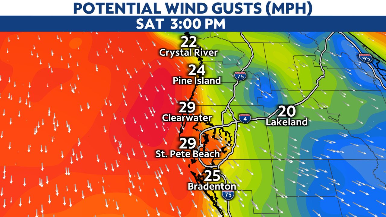
It will be breezy before the storms arrive, but the wind will ramp up quickly as the storms move onshore. Many areas can expect to see wind gusts to 40 mph with a few gusts in excess of 50 mph.
Localized power outages will be possible in areas of high wind gusts.

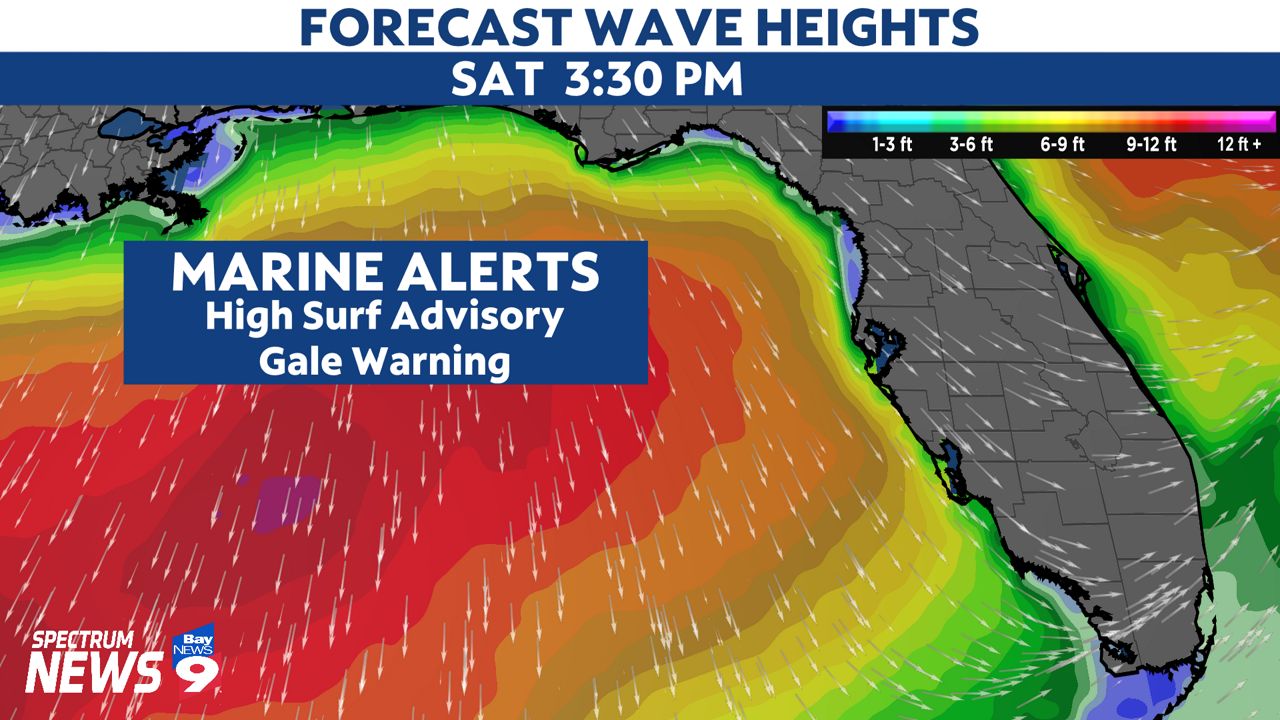
Boating will be very hazardous on Saturday. A Gale Warning and a High Surf Advisory remain in effect for our coastal waters through Sunday morning. Strong offshore winds will result in seas ranging from 6-12 feet off our coastline on Saturday.
Fortunately, the risk for severe storms will quickly end once the main line of thunderstorms passes to the southeast. Storms will clear the area from north to south Saturday afternoon.

Despite the storms clearing, strong northerly winds will continue through the rest of the day. These winds will continue to usher in very cold air, setting the stage for temperatures to plummet during the overnight.
It will become noticeably cooler Saturday afternoon and the temperatures will continue to fall through the evening. You will probably need your jacket if you have plans to head out late Saturday.
In fact, a Freeze Watch has been issued for parts of our area for Saturday night.
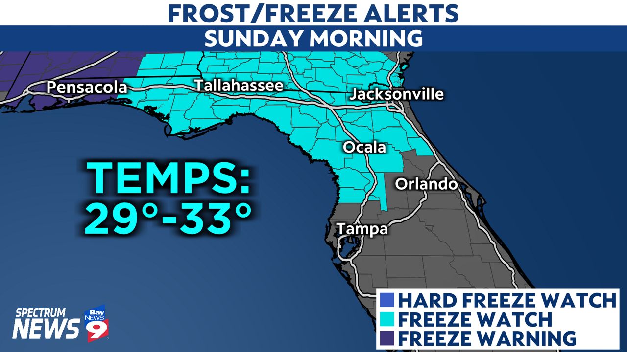
Temperatures are expected to fall into the 30s and 40s with upper 20s possible in the coldest spots. Parts of Citrus and Hernando counties may experience several hours of temperatures at or below freezing Sunday morning.
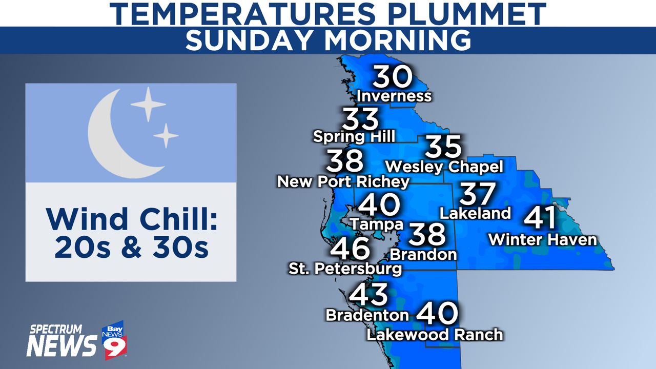
Breezy northerly winds will continue into Sunday, which will make the cold weather feel even colder.
Tampa is expected to experience a wind chill (or feels-like temperature) near freezing Sunday morning, and the wind chill is expected to be as low as the mid-20s north of town.

The saving grace from this upcoming blast of cold weather is the sun, especially this time of the year with a higher sun angle. Temperatures will rise into the mid-60s Sunday afternoon, but under the shining sun, it won't feel all that bad.

While we are talking about the sun, don't forget to turn those clocks ahead one hour!
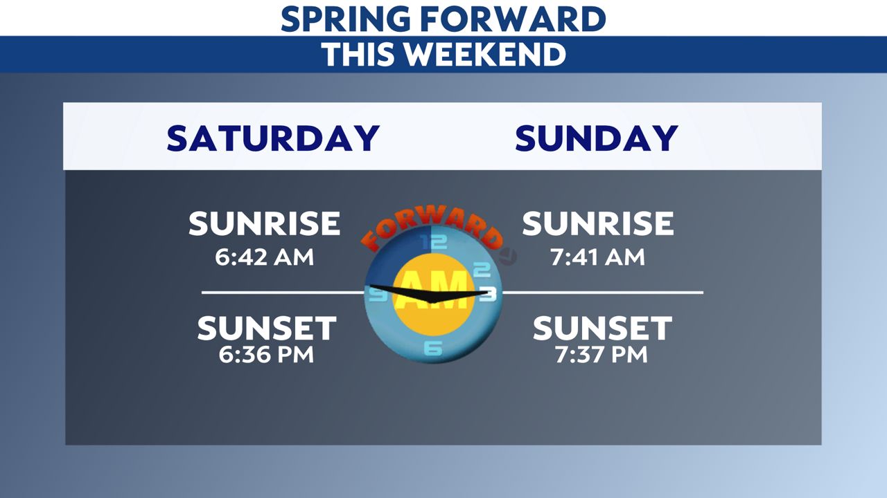
Not only will the time change result in one of Tampa's latest sunrises of 2022, the sun will set at 7:37 p.m. Sunday evening.